|
search place name
|
||
Maguá Abajo (Santiago, Dominican Republic)Maguá Abajo is a town in the Santiago region of Dominican Republic. An overview map of the region around Maguá Abajo is displayed below.
regional and 3d topo map of Maguá Abajo, Dominican Republic ::

Maguá Abajo airports ::
The nearest airport is STI - Santiago Cibao Intl, located 54.1 km east of Maguá Abajo.
Other airports nearby include POP - Puerto Plata Gregorio Luperon Intl (73.0 km north east), CAP - Cap Haitien Intl (120.8 km west), BRX - Barahona Maria Montez Intl (121.6 km south), PAP - Port-au-prince Toussaint Louverture Intl (150.3 km south west), Nearby towns ::
Pies de Jagua (0.0km north) //
Corocito Abajo (1.7km west) //
Corocito (1.7km west) //
Maguá (1.9km north) //
Maguá Arriba (1.9km south) //
La Guaranita (1.7km east) //
El Pino Bueno (1.9km south) //
La Mina (2.5km north west) //
Los Palmaritos (2.5km north west) //
Corocito Arriba (2.5km south west) //
Pananao al Medio (2.5km north east) //
Pananao Arriba (2.5km north east) //
La Laguna (2.5km south east) //
Cabreja (2.5km south east) //
La Mata de Tuna (3.7km north) //
La Joya (3.7km north) //
Rancho de la Cana (3.7km south) //
Loma de la Cana (3.5km west) //
Los Guayuyos (3.5km east) //
Maguá al Medio (4.1km north west) //
Pananao Abajo (4.1km north east) //
Los Sillones (4.1km north east) //
Las Auyamas (4.0km north west) //
La Caba del Hoyazo (4.0km north west) //
Pananao (4.0km north east) //
El Rubio (4.0km north east) //
Los Ranchos (5.1km north west) //
Naranjo (5.1km south west) //
El Guayabo (5.2km west) //
[all distances 'as the bird flies' and approximate] 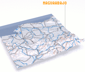 Places with similar names to Maguá Abajo, Dominican Republic ::
// Macá Abajo (CU)
// Miquía Abajo (VE)
// Mucubají (VE)
// Magbeje (NG)
// Mgbege (NG)
// Mugubuja (MZ)
Disclaimer :: Information on this page comes without warranty of any kind |
||
|
Where is Maguá Abajo? Elevation and coordinates ::
Latitude (lat): 19°21'0"N Longitude (lon): 71°7'0"W
Elevation (approx.): 328m (map arrows pan, magnifying glasses zoom) |
||
|
Visiting Maguá Abajo? Hotel/Accommodation ::
Book a hotel in Maguá Abajo Travel Guide ::
rental cars ::
car rental offers GPS waypoint ::
download a GPX waypoint (PoI) of Maguá Abajo for your GPS receiver
|
||