|
search place name
|
||
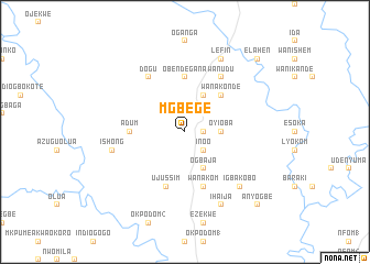
Mgbege (Gongola, Nigeria)Mgbege is a town in the Gongola region of Nigeria. An overview map of the region around Mgbege is displayed below.
regional and 3d topo map of Mgbege, Nigeria ::
Mgbege airports ::
The nearest airport is ENU - Enugu, located 96.5 km west of Mgbege.
Other airports nearby include MDI - Makurdi (118.6 km north), CBQ - Calabar (185.3 km south), BPC - Bamenda (200.5 km east), PHC - Port Hartcourt Port Harcourt Intl (243.0 km south west), Nearby towns ::
Obetegana (1.8km east) //
Ibinta (1.8km east) //
Inoo (2.6km south east) //
Benta (2.6km north east) //
Ibinta (2.6km south east) //
Oyioba (3.7km east) //
Lefin (4.1km north east) //
Ogbaja (4.1km south east) //
Wanakonde (5.2km north east) //
Obendegana (5.6km north) //
Adum (5.5km west) //
Wanakom (5.9km south) //
Ujussim (5.9km south) //
Wanudu (6.7km north east) //
Dogu (6.7km north west) //
Ishong (7.6km west) //
Igbakobo (7.8km south east) //
Lefin (8.3km north east) //
Ihaija (8.3km south east) //
Elahen (10.4km north east) //
Anyogbe (10.4km south east) //
[all distances 'as the bird flies' and approximate] 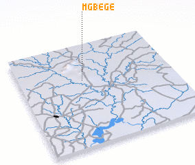 Places with similar names to Mgbege, Nigeria ::
// Macá Abajo (CU)
// Miquía Abajo (VE)
// Mucubají (VE)
// Magbeje (NG)
// Mugubuja (MZ)
// Maguá Abajo (DO)
Disclaimer :: Information on this page comes without warranty of any kind |
||
|
Where is Mgbege? Elevation and coordinates ::
Latitude (lat): 6°39'0"N Longitude (lon): 8°25'0"E
Elevation (approx.): 80m (map arrows pan, magnifying glasses zoom) |
||
|
Visiting Mgbege? Hotel/Accommodation ::
Book a hotel in Mgbege Travel Guide ::
Buy a travel guide for Nigeria rental cars ::
car rental offers GPS waypoint ::
download a GPX waypoint (PoI) of Mgbege for your GPS receiver
|
||