|
search place name
|
||
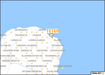
Tetén (María Trinidad Sánchez, Dominican Republic)Tetén is a town in the María Trinidad Sánchez region of Dominican Republic. An overview map of the region around Tetén is displayed below.
regional and 3d topo map of Tetén, Dominican Republic ::
Tetén airports ::
The nearest airport is POP - Puerto Plata Gregorio Luperon Intl, located 69.5 km west of Tetén.
Other airports nearby include STI - Santiago Cibao Intl (77.1 km west), SDQ - Santo Domingo Las Americas Intl (137.6 km south), LRM - La Romana Casa De Campo Intl (169.7 km south east), BRX - Barahona Maria Montez Intl (200.1 km south west), Nearby towns ::
El Puerto (0.0km north) //
Caño Seco (1.7km west) //
Catalinas (1.7km west) //
Laguna Honda (2.5km south west) //
Caya Clara (2.5km south west) //
El Bretón (2.5km north west) //
Cabrera (2.5km south east) //
El Jamo (2.5km south east) //
Loma Alta (3.7km south) //
Las Cuatro Esquinas (3.5km west) //
Los Hicacos (4.1km south west) //
Pozo Hondo (4.1km south west) //
Los Picachos (4.1km south west) //
Media Gorra (4.1km south west) //
La Cruz (4.1km south east) //
Pozo Prieto (4.1km south east) //
Los Valles (4.1km south east) //
Los Naranjitos (4.1km south east) //
Las Escobas (4.0km south west) //
Abreu (4.0km north west) //
La Llanada (5.1km south east) //
La Jagua (5.2km west) //
Los Canjilones (5.8km south) //
El Higo de las Tres Piernas (5.8km south) //
Loma de la Jagua (5.6km west) //
Playa de Navío (5.6km west) //
Los Cacaos (6.6km south west) //
Jina Clara (6.4km south west) //
El Zapote (6.4km south west) //
[all distances 'as the bird flies' and approximate] 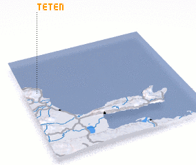 Places with similar names to Tetén, Dominican Republic ::
Disclaimer :: Information on this page comes without warranty of any kind |
||
|
Where is Tetén? Elevation and coordinates ::
Latitude (lat): 19°39'0"N Longitude (lon): 69°55'0"W
Elevation (approx.): 12m (map arrows pan, magnifying glasses zoom) |
||
|
Visiting Tetén? Hotel/Accommodation ::
Book a hotel in Tetén Travel Guide ::
rental cars ::
car rental offers GPS waypoint ::
download a GPX waypoint (PoI) of Tetén for your GPS receiver
|
||