|
search place name
|
||
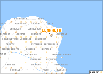
Loma Alta (María Trinidad Sánchez, Dominican Republic)Loma Alta is a town in the María Trinidad Sánchez region of Dominican Republic. An overview map of the region around Loma Alta is displayed below.
regional and 3d topo map of Loma Alta, Dominican Republic ::
Loma Alta airports ::
The nearest airport is POP - Puerto Plata Gregorio Luperon Intl, located 70.3 km west of Loma Alta.
Other airports nearby include STI - Santiago Cibao Intl (75.9 km west), SDQ - Santo Domingo Las Americas Intl (134.0 km south), LRM - La Romana Casa De Campo Intl (166.9 km south east), BRX - Barahona Maria Montez Intl (197.3 km south west), Nearby towns ::
Pozo Hondo (1.7km west) //
Los Hicacos (1.7km west) //
Los Picachos (1.7km west) //
Media Gorra (1.7km west) //
Pozo Prieto (1.7km east) //
La Cruz (1.7km east) //
Los Naranjitos (1.7km east) //
Los Valles (1.7km east) //
Laguna Honda (2.5km north west) //
Caya Clara (2.5km north west) //
El Jamo (2.5km north east) //
Cabrera (2.5km north east) //
Los Canjilones (2.5km south east) //
El Higo de las Tres Piernas (2.5km south east) //
Tetén (3.7km north) //
El Puerto (3.7km north) //
La Llanada (3.5km east) //
Pozo Amarillo (3.7km south) //
Catalinas (4.1km north west) //
Caño Seco (4.1km north west) //
Las Escobas (4.0km north west) //
Los Cacaos (4.0km south west) //
El Diamante (4.1km south east) //
Las Cuatro Esquinas (5.1km north west) //
La Capilla (5.1km south west) //
El Zapote (5.2km west) //
Jina Clara (5.2km west) //
El Picao (5.8km south) //
La Vereda (5.8km south) //
[all distances 'as the bird flies' and approximate] 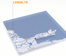 Places with similar names to Loma Alta, Dominican Republic ::
Disclaimer :: Information on this page comes without warranty of any kind |
||
|
Where is Loma Alta? Elevation and coordinates ::
Latitude (lat): 19°37'0"N Longitude (lon): 69°55'0"W
Elevation (approx.): 196m (map arrows pan, magnifying glasses zoom) |
||
|
Visiting Loma Alta? Hotel/Accommodation ::
Book a hotel in Loma Alta Travel Guide ::
rental cars ::
car rental offers GPS waypoint ::
download a GPX waypoint (PoI) of Loma Alta for your GPS receiver
|
||