|
search place name
|
||
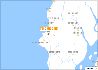
Champang (Myanmar)Champang is a town in Myanmar. An overview map of the region around Champang is displayed below.
regional and 3d topo map of Champang, Myanmar ::
Champang airports ::
The nearest airport is NST - Nakhon Si Thammarat Cha Ian, located 249.5 km south east of Champang.
Nearby towns ::
Ulu Champang (1.8km east) //
Talok Chena (2.6km north west) //
Kuala Champang (2.6km south west) //
Talok Nipa (3.7km north) //
Kampong Mah Puteh (5.2km south west) //
Talok Babai (5.9km north) //
Pase Panjang (7.6km south) //
[all distances 'as the bird flies' and approximate] 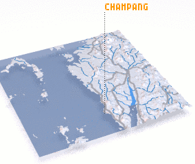 Places with similar names to Champang, Myanmar ::
// Chimpanga (ZM)
// Chimpunga (ZM)
// Shamapango (ZM)
// Shimapango (PE)
// Chamepango (MZ)
// Shuimoping (CN)
// Chamhpang (MM)
// Champongo (MW)
// Chimpangu (MW)
Disclaimer :: Information on this page comes without warranty of any kind |
||
|
Where is Champang? Elevation and coordinates ::
Latitude (lat): 10°13'0"N Longitude (lon): 98°31'0"E
Elevation (approx.): 19m (map arrows pan, magnifying glasses zoom) |
||
|
Visiting Champang? Hotel/Accommodation ::
Book a hotel in Champang Travel Guide ::
Buy a travel guide for Myanmar rental cars ::
car rental offers GPS waypoint ::
download a GPX waypoint (PoI) of Champang for your GPS receiver
|
||