|
search place name
|
||
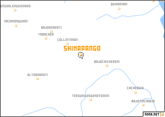
Shimapango (Junín, Peru)Shimapango is a town in the Junín region of Peru. An overview map of the region around Shimapango is displayed below.
regional and 3d topo map of Shimapango, Peru ::
Shimapango airports ::
The nearest airport is AYP - Ayacucho Coronel Fap Alfredo Mendivil Duarte, located 159.2 km south of Shimapango.
Other airports nearby include ANS - Andahuaylas (240.1 km south east), Nearby towns ::
Collintimari (4.8km north west) //
Bajo Chichereni (5.6km east) //
Bajo Anapatí (9.3km north west) //
Yabachea (9.4km north west) //
[all distances 'as the bird flies' and approximate] 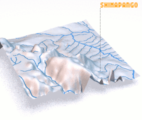 Places with similar names to Shimapango, Peru ::
// Chimpanga (ZM)
// Chimpunga (ZM)
// Shamapango (ZM)
// Chamepango (MZ)
// Shuimoping (CN)
// Chamhpang (MM)
// Champang (MM)
// Champongo (MW)
// Chimpangu (MW)
Disclaimer :: Information on this page comes without warranty of any kind |
||
|
Where is Shimapango? Elevation and coordinates ::
Latitude (lat): 11°42'59"S Longitude (lon): 74°13'54"W
Elevation (approx.): 762m (map arrows pan, magnifying glasses zoom) |
||
|
Visiting Shimapango? Hotel/Accommodation ::
Book a hotel in Shimapango Travel Guide ::
Buy a travel guide for Peru rental cars ::
car rental offers GPS waypoint ::
download a GPX waypoint (PoI) of Shimapango for your GPS receiver
|
||