|
search place name
|
||
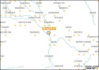
Kandaw (Mandalay, Myanmar)Kandaw is a town in the Mandalay region of Myanmar. An overview map of the region around Kandaw is displayed below.
regional and 3d topo map of Kandaw, Myanmar ::
Kandaw airports ::
The nearest airport is MDL - Mandalay Intl, located 59.6 km north west of Kandaw.
Other airports nearby include HEH - Heho (75.8 km south east), LSH - Lashio (240.5 km north east), Nearby towns ::
Ingon (1.9km north) //
Myatlebin (1.7km east) //
Peinhnebin (1.9km south) //
Aungbauk (3.7km north) //
Maunggwe (3.7km south) //
Myanadi (4.1km north west) //
Put-in (4.1km south east) //
Taungdaw (5.2km west) //
Pyilon-an (5.8km north) //
Hti-laing (6.5km north east) //
Natlwe (6.5km north west) //
Indawgaing (7.6km north) //
Gonyo (7.2km east) //
Dawe-in (7.6km north) //
Kyobin (7.2km east) //
Kyauktalon (7.6km north west) //
Indayaw (8.2km north west) //
Thazi (9.0km north west) //
[all distances 'as the bird flies' and approximate] 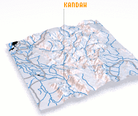 Places with similar names to Kandaw, Myanmar ::
Disclaimer :: Information on this page comes without warranty of any kind |
||
|
Where is Kandaw? Elevation and coordinates ::
Latitude (lat): 21°16'0"N Longitude (lon): 96°19'0"E
Elevation (approx.): 127m (map arrows pan, magnifying glasses zoom) |
||
|
Visiting Kandaw? Hotel/Accommodation ::
Book a hotel in Kandaw Travel Guide ::
Buy a travel guide for Myanmar rental cars ::
car rental offers GPS waypoint ::
download a GPX waypoint (PoI) of Kandaw for your GPS receiver
|
||