|
search place name
|
||
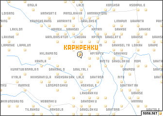
Kaphpe-hku (Kayah, Myanmar)Kaphpe-hku is a town in the Kayah region of Myanmar. An overview map of the region around Kaphpe-hku is displayed below.
regional and 3d topo map of Kaphpe-hku, Myanmar ::
Kaphpe-hku airports ::
The nearest airport is HEH - Heho, located 123.9 km north of Kaphpe-hku.
Nearby towns ::
Daw Ta-ho (1.9km north) //
Daw Ta-hsö (1.7km east) //
Nammekon (1.7km east) //
La-kya Dawhsè (2.5km north west) //
La-hya-daw (2.5km north west) //
Wān Namhu (2.5km north west) //
Likku-in (2.5km north east) //
Daw Pi-ta (2.5km south east) //
Lwè-daw (3.7km north) //
Hpya-pyu (3.5km east) //
Daw Lya-li (3.7km south) //
Daw Glaw-tu (3.7km south) //
Kunghsa (4.0km north east) //
Pawktaw (4.0km north east) //
Hpya-ni (4.0km north east) //
Daw Glo-hku (4.1km north west) //
Daw Lya-hkü (4.1km north west) //
Wi-sa-ku (4.1km north east) //
Hpya-ni (5.1km north east) //
Hsè-hsu-lè (5.6km south) //
La-lè (5.6km south) //
Daw Htra-hku (5.6km north) //
Daw Hsè-i (5.8km north) //
Hklawpenghko (5.6km west) //
Hkè-tu (5.6km east) //
Wān Loi-hsa-tūn (6.4km north west) //
Kwè-hsawdaw (6.6km south west) //
Wān Loi-kwai (6.6km north west) //
Hpya-ni (6.6km north east) //
[all distances 'as the bird flies' and approximate] 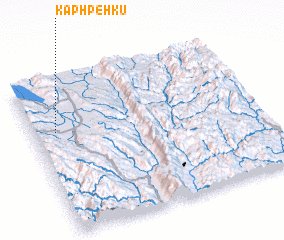 Places with similar names to Kaphpe-hku, Myanmar :: Disclaimer :: Information on this page comes without warranty of any kind |
||
|
Where is Kaphpe-hku? Elevation and coordinates ::
Latitude (lat): 19°40'0"N Longitude (lon): 97°6'0"E
Elevation (approx.): 1065m (map arrows pan, magnifying glasses zoom) |
||
|
Visiting Kaphpe-hku? Hotel/Accommodation ::
Book a hotel in Kaphpe-hku Travel Guide ::
Buy a travel guide for Myanmar rental cars ::
car rental offers GPS waypoint ::
download a GPX waypoint (PoI) of Kaphpe-hku for your GPS receiver
|
||