|
search place name
|
||
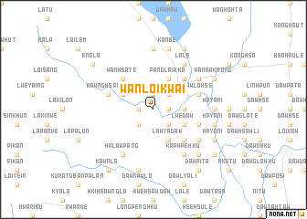
Wān Loi-kwai (Shan, Myanmar)Wān Loi-kwai is a town in the Shan region of Myanmar. An overview map of the region around Wān Loi-kwai is displayed below.
regional and 3d topo map of Wān Loi-kwai, Myanmar ::
Wān Loi-kwai airports ::
The nearest airport is HEH - Heho, located 117.6 km north of Wān Loi-kwai.
Other airports nearby include MDL - Mandalay Intl (247.3 km north west), Nearby towns ::
Daw Pawgle (1.9km north) //
Wān Ai-htè (1.9km north) //
Daw Hsè-i (1.7km east) //
Hai-pek (1.7km west) //
Mobyè (2.5km north east) //
Daw Glo-hku (2.5km south east) //
Daw Lya-hkü (2.5km south east) //
Wān Loi-hsa-tūn (2.5km south west) //
Daw Htra-hku (3.5km east) //
Panglai-hka (4.1km north east) //
Lwè-daw (4.0km south east) //
La-kya Dawhsè (4.1km south east) //
La-kyi-nampai (4.0km north west) //
La-hya-daw (4.1km south east) //
Wān Namhu (4.1km south east) //
Dawma Kla (5.1km north east) //
Daw Ta-ho (5.1km south east) //
Wān Hsa-tè (5.1km north west) //
Kawnghsawng (5.6km west) //
Daw Lo-hsè (5.6km east) //
Wi-sa-ku (5.6km east) //
La-lè (6.6km north east) //
Hsawlya-daw (6.4km north east) //
Kaphpe-hku (6.6km south east) //
Likku-in (6.4km south east) //
Hklawpang (6.6km south west) //
Hkawngmeng (7.4km north) //
Hpya-ni (7.0km east) //
Hsawhkyi-daw (7.0km east) //
[all distances 'as the bird flies' and approximate] 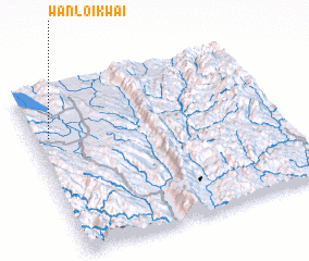 Places with similar names to Wān Loi-kwai, Myanmar :: Disclaimer :: Information on this page comes without warranty of any kind |
||
|
Where is Wān Loi-kwai? Elevation and coordinates ::
Latitude (lat): 19°43'0"N Longitude (lon): 97°4'0"E
Elevation (approx.): 898m (map arrows pan, magnifying glasses zoom) |
||
|
Visiting Wān Loi-kwai? Hotel/Accommodation ::
Book a hotel in Wān Loi-kwai Travel Guide ::
Buy a travel guide for Myanmar rental cars ::
car rental offers GPS waypoint ::
download a GPX waypoint (PoI) of Wān Loi-kwai for your GPS receiver
|
||