|
search place name
|
||
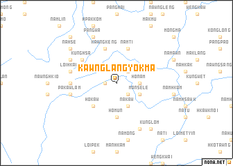
Kawnglangyokma (Shan, Myanmar)Kawnglangyokma is a town in the Shan region of Myanmar. An overview map of the region around Kawnglangyokma is displayed below.
regional and 3d topo map of Kawnglangyokma, Myanmar ::
Kawnglangyokma airports ::
The nearest airport is LSH - Lashio, located 53.9 km north west of Kawnglangyokma.
Other airports nearby include KET - Kengtung (215.6 km south east), HEH - Heho (259.8 km south west), Nearby towns ::
Möng Tawm (1.7km west) //
Wenghong (2.5km south east) //
Hwe-kut (2.5km north east) //
Ho-nam (3.4km east) //
Na-kaw (4.1km south east) //
Mān Se-le (3.9km south east) //
Ho-kaw (5.0km south west) //
Ho-mun (5.6km south) //
Kawngkeng (5.8km north) //
Namti (5.8km north) //
Kunghsa (6.3km north west) //
Namkat (6.8km west) //
Pa-kawlam (7.1km west) //
Loi-hkan (7.1km west) //
Namhsim (7.8km north west) //
Pāngwa (8.2km north west) //
Pungpang (8.2km south east) //
Na-hse (8.8km north west) //
Kunglom (9.0km south east) //
Nawngkyang (10.1km north west) //
[all distances 'as the bird flies' and approximate] 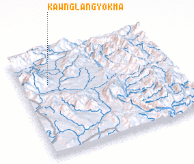 Places with similar names to Kawnglangyokma, Myanmar :: Disclaimer :: Information on this page comes without warranty of any kind |
||
|
Where is Kawnglangyokma? Elevation and coordinates ::
Latitude (lat): 22°42'0"N Longitude (lon): 98°11'0"E
Elevation (approx.): 1083m (map arrows pan, magnifying glasses zoom) |
||
|
Visiting Kawnglangyokma? Hotel/Accommodation ::
Book a hotel in Kawnglangyokma Travel Guide ::
Buy a travel guide for Myanmar rental cars ::
car rental offers GPS waypoint ::
download a GPX waypoint (PoI) of Kawnglangyokma for your GPS receiver
|
||