|
search place name
|
||
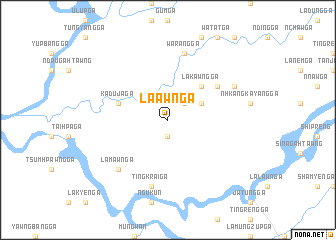
La-awn Ga (Kachin State, Myanmar)La-awn Ga is a town in the Kachin State region of Myanmar. An overview map of the region around La-awn Ga is displayed below.
regional and 3d topo map of La-awn Ga, Myanmar ::
La-awn Ga airports ::
The nearest airport is PBU - Putao, located 121.9 km north east of La-awn Ga.
Other airports nearby include MYT - Myitkyina (146.4 km south east), MOH - Mohanbari Dibrugarh (190.2 km north west), Nearby towns ::
Gashang Ga (1.9km south) //
Sinlung Ga (2.5km north east) //
Janhtang Ga (3.8km north east) //
Lakawng Ga (5.0km north east) //
Tumhpang Ga (5.0km north east) //
Kaduja Ga (5.3km west) //
Chenam Ga (6.2km north east) //
Warang Ga (7.6km north) //
Tingkrai Ga (7.6km south) //
Lamawn Ga (7.5km south west) //
'Nzang Ga (7.6km north east) //
[all distances 'as the bird flies' and approximate] 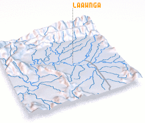 Places with similar names to La-awn Ga, Myanmar ::
Disclaimer :: Information on this page comes without warranty of any kind |
||
|
Where is La-awn Ga? Elevation and coordinates ::
Latitude (lat): 26°31'0"N Longitude (lon): 96°36'0"E
Elevation (approx.): 219m (map arrows pan, magnifying glasses zoom) |
||
|
Visiting La-awn Ga? Hotel/Accommodation ::
Book a hotel in La-awn Ga Travel Guide ::
Buy a travel guide for Myanmar rental cars ::
car rental offers GPS waypoint ::
download a GPX waypoint (PoI) of La-awn Ga for your GPS receiver
|
||