|
search place name
|
||
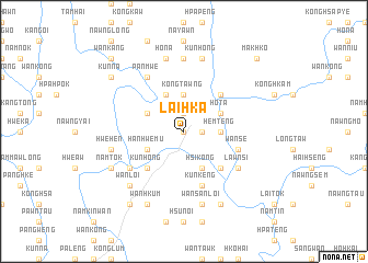
Lai-hka (Shan, Myanmar)Lai-hka is a town in the Shan region of Myanmar. An overview map of the region around Lai-hka is displayed below.
regional and 3d topo map of Lai-hka, Myanmar ::
Lai-hka airports ::
The nearest airport is HEH - Heho, located 107.6 km south west of Lai-hka.
Other airports nearby include MDL - Mandalay Intl (181.5 km west), MOG - Mong Hsat (185.1 km south east), LSH - Lashio (189.7 km north), KET - Kengtung (204.4 km east), Nearby towns ::
Kongleng (0.0km north) //
Nawngmöng (1.9km north) //
Honawng (1.9km north) //
Nawngpang (1.9km north) //
Honawng (1.7km east) //
Ho-nawng-un (1.7km east) //
Kongtawng (3.7km north) //
Hemtēng (3.5km east) //
Maklang (3.9km north east) //
Hōta (3.9km north east) //
Nawngpit (4.1km north west) //
Haihkam (3.9km north west) //
Hsi-kong (4.1km south east) //
Hanhwe-mu (3.9km south west) //
Kawnghkam (5.1km north east) //
Möngpat (5.1km north east) //
Wan Loi-na (5.1km south east) //
Kongnyawng (5.1km south east) //
Kunhong (5.1km south west) //
Kunkèng (5.8km south) //
Nawngnik (5.8km south) //
Wānsè (5.5km east) //
Panmwe (6.5km north west) //
Hwè-lau-wānloi (6.4km south west) //
Wān Lawk (6.4km south east) //
Lawnsi (6.4km south east) //
Wānpum (7.4km north) //
Wānmau (7.4km north) //
Kunhong (7.6km north) //
[all distances 'as the bird flies' and approximate] 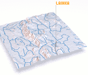 Places with similar names to Lai-hka, Myanmar ::
Disclaimer :: Information on this page comes without warranty of any kind |
||
|
Where is Lai-hka? Elevation and coordinates ::
Latitude (lat): 21°16'0"N Longitude (lon): 97°40'0"E
Elevation (approx.): 964m (map arrows pan, magnifying glasses zoom) |
||
|
Visiting Lai-hka? Hotel/Accommodation ::
Book a hotel in Lai-hka Travel Guide ::
Buy a travel guide for Myanmar rental cars ::
car rental offers GPS waypoint ::
download a GPX waypoint (PoI) of Lai-hka for your GPS receiver
|
||