|
search place name
|
||
Loi Kēng (Shan, Myanmar)Loi Kēng is a town in the Shan region of Myanmar. An overview map of the region around Loi Kēng is displayed below.
regional and 3d topo map of Loi Kēng, Myanmar ::

Loi Kēng airports ::
The nearest airport is LSH - Lashio, located 111.0 km north of Loi Kēng.
Other airports nearby include HEH - Heho (161.4 km south west), MDL - Mandalay Intl (172.2 km west), MOG - Mong Hsat (235.3 km south east), Nearby towns ::
Nā-u (1.7km east) //
Neng-hkio (1.7km west) //
Mankat (3.4km west) //
Mān Nang-yaw (5.1km north east) //
Hwe-lok (5.2km east) //
Ho-hkai (5.2km west) //
Loi-sīn (5.6km south) //
Panghsa (5.6km south) //
Loi-pwe (6.4km south west) //
Nā-un (6.5km south east) //
Nā-lo (7.6km south) //
Nam Pon (7.1km west) //
Wan Tawng (8.2km south east) //
Konghsa (8.2km south west) //
Möng Hso (8.2km south west) //
Mān Pang-tap (7.8km north east) //
Möng Tung (8.8km north east) //
Mān Sawng (8.8km north east) //
Kunti (8.8km north east) //
Mān Hawn (10.1km north east) //
Pāngkwai (10.1km north east) //
[all distances 'as the bird flies' and approximate] 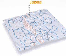 Places with similar names to Loi Kēng, Myanmar ::
Disclaimer :: Information on this page comes without warranty of any kind |
||
|
Where is Loi Kēng? Elevation and coordinates ::
Latitude (lat): 21°59'0"N Longitude (lon): 97°37'0"E
Elevation (approx.): 1198m (map arrows pan, magnifying glasses zoom) |
||
|
Visiting Loi Kēng? Hotel/Accommodation ::
Book a hotel in Loi Kēng Travel Guide ::
Buy a travel guide for Myanmar rental cars ::
car rental offers GPS waypoint ::
download a GPX waypoint (PoI) of Loi Kēng for your GPS receiver
|
||