|
search place name
|
||
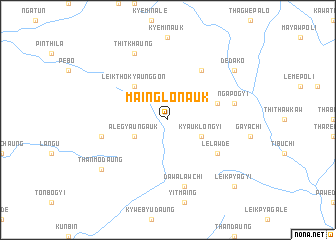
Mainglon Auk (Kayin, Myanmar)Mainglon Auk is a town in the Kayin region of Myanmar. An overview map of the region around Mainglon Auk is displayed below.
regional and 3d topo map of Mainglon Auk, Myanmar ::
Mainglon Auk airports ::
The nearest airport is HEH - Heho, located 174.1 km north of Mainglon Auk.
Nearby towns ::
Kyauklongyi (4.0km south east) //
Alegyaung Auk (4.0km south west) //
Leiktho Kyaunggon (5.1km north west) //
Leiktho (5.1km north west) //
Ngapogale (5.6km east) //
Lelawde (6.4km south east) //
Naplawkaw (6.6km north east) //
Dawalawchi (7.6km south) //
Ngapogyi (7.2km east) //
Zale Ale (7.2km west) //
Thitkhaung (8.2km north west) //
Dedako (8.9km north east) //
Thanmodaung (8.9km south west) //
Leikpyagyi (10.2km south east) //
[all distances 'as the bird flies' and approximate] 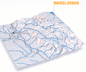 Places with similar names to Mainglon Auk, Myanmar ::
// Mānglang (MM)
// Mang Leng (MM)
// Man Hko-ling (MM)
// Mān-kao-long (MM)
// Mān-kao-long (MM)
// Mān-kao-long (MM)
// Mān-kao-lōng (MM)
// Mān-kau-lōng (MM)
// Mān-kau-lōng (MM)
// Mān Kaw-leng (MM)
Disclaimer :: Information on this page comes without warranty of any kind |
||
|
Where is Mainglon Auk? Elevation and coordinates ::
Latitude (lat): 19°11'0"N Longitude (lon): 96°37'0"E
Elevation (approx.): 1001m (map arrows pan, magnifying glasses zoom) |
||
|
Visiting Mainglon Auk? Hotel/Accommodation ::
Book a hotel in Mainglon Auk Travel Guide ::
Buy a travel guide for Myanmar rental cars ::
car rental offers GPS waypoint ::
download a GPX waypoint (PoI) of Mainglon Auk for your GPS receiver
|
||