|
search place name
|
||
Mān Tak (Shan, Myanmar)Mān Tak is a town in the Shan region of Myanmar. An overview map of the region around Mān Tak is displayed below.
regional and 3d topo map of Mān Tak, Myanmar ::

Mān Tak airports ::
The nearest airport is LSH - Lashio, located 109.2 km south west of Mān Tak.
Other airports nearby include MYT - Myitkyina (223.8 km north west), Nearby towns ::
Mān Nawnghiu (2.5km north east) //
Mān Loi-kang (2.5km north west) //
Mān Panghkem (2.5km south west) //
Mān Nawngsang (3.9km north east) //
Mān Wengtang (4.1km north east) //
Mān Lūngmi (3.9km south east) //
Mān Loi-kang (4.1km north west) //
Mān Hō-la (5.0km south west) //
Mān Pū-hsi-htao (5.1km west) //
Mān Wa-sü-sai (5.6km north) //
Mān Ho-si (5.4km west) //
Mān Tünmong (5.8km south) //
Mān Namtawng (5.8km north) //
Wān Hsiensha (5.4km east) //
Mān Ta-hswē-ko (5.8km north) //
Mān Sangsa-sai (6.5km north west) //
Mān Nawngmo (7.4km north) //
Mān Namtawng (7.4km north) //
Mān Kawng-hka (6.8km west) //
Mān Ma-hsan (7.6km north) //
Mān Kūnghsa (7.6km north) //
Mān Nawnghkam (7.6km south) //
Mān Lao-lu-zai (7.5km north west) //
Mān Ta-hu (8.2km north east) //
Mān Nanwa (7.7km north east) //
Mān Lao-hsenzai (7.7km north west) //
Mān Nawngsang (8.2km south west) //
Mān Nawnghkam (8.2km south west) //
Mān Kawng Song (9.0km south east) //
[all distances 'as the bird flies' and approximate] 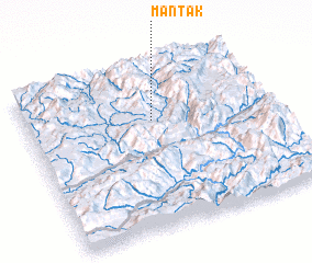 Places with similar names to Mān Tak, Myanmar ::
Disclaimer :: Information on this page comes without warranty of any kind |
||
|
Where is Mān Tak? Elevation and coordinates ::
Latitude (lat): 23°40'0"N Longitude (lon): 98°31'0"E
Elevation (approx.): 1216m (map arrows pan, magnifying glasses zoom) |
||
|
Visiting Mān Tak? Hotel/Accommodation ::
Book a hotel in Mān Tak Travel Guide ::
Buy a travel guide for Myanmar rental cars ::
car rental offers GPS waypoint ::
download a GPX waypoint (PoI) of Mān Tak for your GPS receiver
|
||