|
search place name
|
||
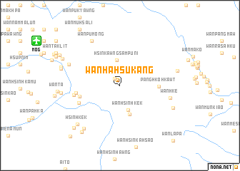
Wān Ha-hsu-kang (Shan, Myanmar)Wān Ha-hsu-kang is a town in the Shan region of Myanmar. An overview map of the region around Wān Ha-hsu-kang is displayed below.
regional and 3d topo map of Wān Ha-hsu-kang, Myanmar ::
Wān Ha-hsu-kang airports ::
The nearest airport is MOG - Mong Hsat, located 14.0 km north west of Wān Ha-hsu-kang.
Other airports nearby include THL - Tachilek Tachileik (58.7 km east), KET - Kengtung (97.7 km north), Nearby towns ::
Wān Hsinpawmöng (1.3km north west) //
Hsinkawngsampu-ni (4.0km north) //
Wān Hsinhkek (4.0km south) //
Wān Ekhka (4.1km north west) //
Wān Hsinhkek (4.7km south) //
Pānghkö-hkawt (5.7km east) //
Wān Nā (6.2km west) //
Wān Kawng (6.5km west) //
Wān Hwè-neng (6.6km south west) //
Wān Hong (6.9km west) //
Wān Hkè (7.7km east) //
Wān Pu-möng (8.1km north west) //
Hsai-leng (8.2km north west) //
Wān Pawön (8.6km south west) //
Hsinhkek (8.7km south west) //
Wān Hkē (8.6km south east) //
Wān Sahsi (9.1km south west) //
Hsin-hsi-li (9.4km south west) //
Wān Mū-hsā-li (10.6km north west) //
Hsin-om (10.8km south west) //
Wān La-pa (11.6km south east) //
[all distances 'as the bird flies' and approximate] 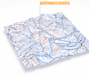 Places with similar names to Wān Ha-hsu-kang, Myanmar :: Disclaimer :: Information on this page comes without warranty of any kind |
||
|
Where is Wān Ha-hsu-kang? Elevation and coordinates ::
Latitude (lat): 20°27'15"N Longitude (lon): 99°22'24"E
Elevation (approx.): 825m (map arrows pan, magnifying glasses zoom) |
||
|
Visiting Wān Ha-hsu-kang? Hotel/Accommodation ::
Book a hotel in Wān Ha-hsu-kang Travel Guide ::
Buy a travel guide for Myanmar rental cars ::
car rental offers GPS waypoint ::
download a GPX waypoint (PoI) of Wān Ha-hsu-kang for your GPS receiver
|
||