|
search place name
|
||
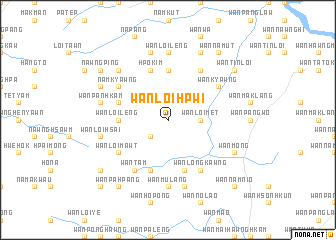
Wān Loi-hpwi (Shan, Myanmar)Wān Loi-hpwi is a town in the Shan region of Myanmar. An overview map of the region around Wān Loi-hpwi is displayed below.
regional and 3d topo map of Wān Loi-hpwi, Myanmar ::
Wān Loi-hpwi airports ::
The nearest airport is LSH - Lashio, located 130.0 km north of Wān Loi-hpwi.
Other airports nearby include KET - Kengtung (176.1 km east), HEH - Heho (176.2 km south west), MOG - Mong Hsat (193.4 km south east), THL - Tachilek Tachileik (247.7 km south east), Nearby towns ::
Wān Nampa-law (1.9km north) //
Wān Loi-hsang (2.5km south west) //
Wān Nawng (2.5km south west) //
Wān Loi-met (3.4km east) //
Wān Loi-leng (5.2km west) //
Panglaw (5.6km north) //
Hpo-kim (5.8km north) //
Wān Kongnio (5.8km south) //
Wān Namtakhkek (5.5km west) //
Wān Hawngkyawng (5.8km south) //
Wān Loimawt (6.4km south west) //
Wān Tam (6.5km south west) //
Namkyawng (6.4km north west) //
Wān Longkawng (6.5km south east) //
Wān Hkawkhsang (6.5km north east) //
Wān Kyawng (6.4km north east) //
Wān Mu-lang (7.4km south) //
Wān Loi-leng (7.4km north) //
Wān Loi-hsai (7.1km west) //
Wān Panhkam (7.1km west) //
Wān Kio-tawng (7.6km south) //
Longhsam (7.6km north) //
Maklang (7.6km north west) //
Namhsong (7.6km north west) //
Luklong (7.8km north west) //
Wān Möng (7.8km south east) //
Wān Hwè-hè (8.2km north east) //
Wān Nawnghsi (8.8km south west) //
Nawngping (8.8km north west) //
[all distances 'as the bird flies' and approximate] 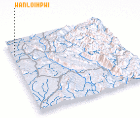 Places with similar names to Wān Loi-hpwi, Myanmar ::
// Wān Loi-hpwi (MM)
// Wān Loi-pwi (MM)
Disclaimer :: Information on this page comes without warranty of any kind |
||
|
Where is Wān Loi-hpwi? Elevation and coordinates ::
Latitude (lat): 21°50'0"N Longitude (lon): 98°2'0"E
Elevation (approx.): 1048m (map arrows pan, magnifying glasses zoom) |
||
|
Visiting Wān Loi-hpwi? Hotel/Accommodation ::
Book a hotel in Wān Loi-hpwi Travel Guide ::
Buy a travel guide for Myanmar rental cars ::
car rental offers GPS waypoint ::
download a GPX waypoint (PoI) of Wān Loi-hpwi for your GPS receiver
|
||