|
search place name
|
||
Domaine dʼArbal (Aïn Temouchent, Wilaya de, Algeria)Domaine dʼArbal is a town in the Aïn Temouchent, Wilaya de region of Algeria. An overview map of the region around Domaine dʼArbal is displayed below.
regional and 3d topo map of Domaine dʼArbal, Algeria ::

Domaine dʼArbal airports ::
The nearest airport is TAF - Oran Tafaraoui, located 11.9 km north east of Domaine dʼArbal.
Other airports nearby include ORN - Oran Es Senia (18.1 km north), MUW - Ghriss (75.0 km east), TLM - Tlemcen Zenata (90.4 km south west), OUD - Oujda Angads (140.6 km south west), Nearby towns ::
Djafra (3.8km north east) //
Kedadra (4.4km west) //
Choualia Fouaga (4.6km west) //
Oulad Youssef (5.0km north west) //
Douar Douaïmia (6.2km north east) //
Tamzoura (6.6km south west) //
Mekhalif (6.6km east) //
Douar Chaïba (8.1km south west) //
Douar Ouarlia (9.3km north east) //
[all distances 'as the bird flies' and approximate] 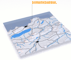 Places with similar names to Domaine dʼArbal, Algeria ::
// Tomandar-e Bālā (IR)
Disclaimer :: Information on this page comes without warranty of any kind |
||
|
Where is Domaine dʼArbal? Elevation and coordinates ::
Latitude (lat): 35°27'40"N Longitude (lon): 0°37'5"W
Elevation (approx.): 130m (map arrows pan, magnifying glasses zoom) |
||
|
Visiting Domaine dʼArbal? Hotel/Accommodation ::
Book a hotel in Domaine dʼArbal Travel Guide ::
Buy a travel guide for Algeria rental cars ::
car rental offers GPS waypoint ::
download a GPX waypoint (PoI) of Domaine dʼArbal for your GPS receiver
|
||