|
search place name
|
||
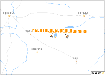
Mechta Ouled Amara (Algeria)Mechta Ouled Amara is a town in Algeria. An overview map of the region around Mechta Ouled Amara is displayed below.
regional and 3d topo map of Mechta Ouled Amara, Algeria ::
Mechta Ouled Amara airports ::
The nearest airport is TEE - Tebessa Cheikh Larbi Tebessi, located 76.4 km east of Mechta Ouled Amara.
Other airports nearby include CZL - Constantine Mohamed Boudiaf Intl (117.3 km north west), BSK - Biskra (154.6 km south west), AAE - Annaba (168.3 km north), GAF - Gafsa (175.4 km south east), Nearby towns ::
Mechta Ouled Belkassem Ben Soltane (0.8km east) //
Mechta Bracha (1.9km north) //
Mechta Ouled Amara (4.5km east) //
Ksar Zazia (6.9km south west) //
Tazougart (6.6km west) //
Zoui (10.9km south east) //
[all distances 'as the bird flies' and approximate] 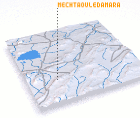 Places with similar names to Mechta Ouled Amara, Algeria ::
// Mechta Oulad Ou Ameur (DZ)
// Mechta Ouled Ahmar (DZ)
// Mechta Ouled Amar (DZ)
// Mechta Ouled Amara (DZ)
Disclaimer :: Information on this page comes without warranty of any kind |
||
|
Where is Mechta Ouled Amara? Elevation and coordinates ::
Latitude (lat): 35°22'0"N Longitude (lon): 7°17'0"E
Elevation (approx.): 1063m (map arrows pan, magnifying glasses zoom) |
||
|
Visiting Mechta Ouled Amara? Hotel/Accommodation ::
Book a hotel in Mechta Ouled Amara Travel Guide ::
Buy a travel guide for Algeria rental cars ::
car rental offers GPS waypoint ::
download a GPX waypoint (PoI) of Mechta Ouled Amara for your GPS receiver
|
||