|
search place name
|
||
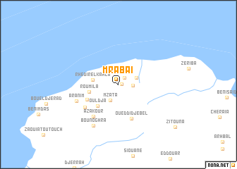
Mrabaï (Skikda, Algeria)Mrabaï is a town in the Skikda region of Algeria. An overview map of the region around Mrabaï is displayed below.
regional and 3d topo map of Mrabaï, Algeria ::
Mrabaï airports ::
The nearest airport is GJL - Jijel, located 53.3 km south west of Mrabaï.
Other airports nearby include CZL - Constantine Mohamed Boudiaf Intl (88.8 km south), BJA - Bejaja Soummam (122.7 km west), AAE - Annaba (129.9 km east), TEE - Tebessa Cheikh Larbi Tebessi (238.4 km south east), Nearby towns ::
Raroui (0.5km east) //
Bou Djama (1.3km north east) //
Kanouâ (1.8km east) //
Kerba (2.6km north west) //
Mzata (2.7km south) //
El Hafeur (2.5km north east) //
Rhedir el Kahla (3.3km west) //
Ouldja (4.4km south west) //
Roumila (3.9km west) //
Bou Alkma (4.7km south west) //
Oued di Djebel (5.6km south) //
Azakour (6.0km south west) //
Bou Lateb (5.6km south west) //
Aranim (5.9km south west) //
Bounoghra (7.3km south west) //
[all distances 'as the bird flies' and approximate] 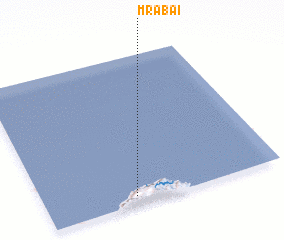 Places with similar names to Mrabaï, Algeria ::
Disclaimer :: Information on this page comes without warranty of any kind |
||
|
Where is Mrabaï? Elevation and coordinates ::
Latitude (lat): 37°3'7"N Longitude (lon): 6°22'46"E
Elevation (approx.): 599m (map arrows pan, magnifying glasses zoom) |
||
|
Visiting Mrabaï? Hotel/Accommodation ::
Book a hotel in Mrabaï Travel Guide ::
Buy a travel guide for Algeria rental cars ::
car rental offers GPS waypoint ::
download a GPX waypoint (PoI) of Mrabaï for your GPS receiver
|
||