|
search place name
|
||
Oulad el Ouali (Algeria)Oulad el Ouali is a town in Algeria. An overview map of the region around Oulad el Ouali is displayed below.
regional and 3d topo map of Oulad el Ouali, Algeria ::

Oulad el Ouali airports ::
The nearest airport is AZR - Adrar Touat Cheikh Sidi Mohamed Belkebir, located 10.1 km north east of Oulad el Ouali.
Other airports nearby include TMX - Timimoun (170.9 km north), Nearby towns ::
Rhozzi (0.0km north) //
Timleha (1.9km north) //
Zaouia Sidi Bekri (3.7km north) //
Tamentit (3.8km south west) //
El Hamra (4.1km south west) //
Bouffaddi (4.1km south west) //
Sidi Ben Hadj (4.1km south west) //
Beni Tamer (7.6km north) //
Mahidia (7.4km north west) //
Oulad Brahim (8.1km north west) //
Allouchia (7.5km south west) //
[all distances 'as the bird flies' and approximate] 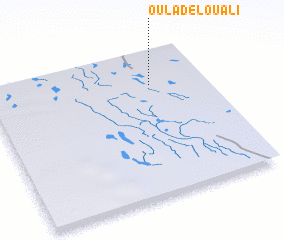 Places with similar names to Oulad el Ouali, Algeria ::
// Oulad Allal (MA)
// Oulad Allal (MA)
// Ouled Allal (MA)
// Oltulili (KE)
// Oulad Allal (MA)
// Oulad Ouilal (MA)
// Oulad ʼAllal (MA)
// Oulad ʼAllal (DZ)
// Oulad el Alia (MA)
// Oulad Allal (DZ)
Disclaimer :: Information on this page comes without warranty of any kind |
||
|
Where is Oulad el Ouali? Elevation and coordinates ::
Latitude (lat): 27°46'0"N Longitude (lon): 0°15'0"W
Elevation (approx.): 236m (map arrows pan, magnifying glasses zoom) |
||
|
Visiting Oulad el Ouali? Hotel/Accommodation ::
Book a hotel in Oulad el Ouali Travel Guide ::
Buy a travel guide for Algeria rental cars ::
car rental offers GPS waypoint ::
download a GPX waypoint (PoI) of Oulad el Ouali for your GPS receiver
|
||