|
search place name
|
||
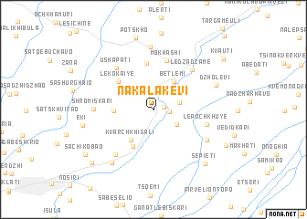
Nakalakevi (Abashis Raioni, Georgia)Nakalakevi is a town in the Abashis Raioni region of Georgia. An overview map of the region around Nakalakevi is displayed below.
regional and 3d topo map of Nakalakevi, Georgia ::
Nakalakevi airports ::
The nearest airport is MRV - Mineralnye Vody Mineralnyye Vody, located 220.5 km north of Nakalakevi.
Nearby towns ::
Gazomela (1.0km east) //
Levakhane (1.4km east) //
Jikha (2.4km east) //
Gejet'i (2.7km south east) //
Bet'lemi (3.9km north east) //
Kvarchkhigali (4.2km south west) //
Kotianeti (3.6km west) //
Zeda-Sorta (4.8km south west) //
Lekokaiye (4.7km north west) //
Meore-Mokhashi (5.7km north) //
Mokhashi (6.2km north) //
Lepochkhuye (5.1km east) //
Ledzadzame (6.0km north east) //
Ushap'at'i (6.1km north west) //
Kʼveda Sorta (6.5km south west) //
Shromiskari (5.4km west) //
Mukhurcha (6.0km south east) //
Legogiye-Nasadzhu (7.6km north) //
Dzholevi (6.4km north east) //
Dzveli Senaki (7.5km south west) //
Eki (6.6km west) //
Sep'iet'i (8.0km south east) //
P'ots'kho (9.0km north) //
Orka (7.8km south east) //
Shkhepi (8.5km south west) //
Sachikobao (8.3km south west) //
Kvauti (8.8km north east) //
[all distances 'as the bird flies' and approximate]  Places with similar names to Nakalakevi, Georgia ::
// Nak'alak'evi (GE)
// Nakalakevi (GE)
Disclaimer :: Information on this page comes without warranty of any kind |
||
|
Where is Nakalakevi? Elevation and coordinates ::
Latitude (lat): 42°20'58"N Longitude (lon): 42°11'30"E
Elevation (approx.): 86m (map arrows pan, magnifying glasses zoom) |
||
|
Visiting Nakalakevi? Hotel/Accommodation ::
Book a hotel in Nakalakevi Travel Guide ::
Buy a travel guide for Georgia rental cars ::
car rental offers GPS waypoint ::
download a GPX waypoint (PoI) of Nakalakevi for your GPS receiver
|
||