|
search place name
|
||
Nakalakevi (Abashis Raioni, Georgia)Nakalakevi is a town in the Abashis Raioni region of Georgia. An overview map of the region around Nakalakevi is displayed below.
regional and 3d topo map of Nakalakevi, Georgia ::

Nakalakevi airports ::
The nearest airport is MRV - Mineralnye Vody Mineralnyye Vody, located 238.5 km north of Nakalakevi.
Nearby towns ::
Beridzhvari (0.9km south) //
Zemo-Goreti (2.1km east) //
Klivana (3.1km south) //
Zemo-Korkula (3.1km south west) //
Zemo K'livana (4.2km south) //
Zemo-Kere (3.4km south west) //
Sabuye (3.9km south west) //
Kvemo-Goreti (3.7km south east) //
Disevi (3.8km west) //
Pantnauri (4.9km south west) //
Eldzarta (5.1km south) //
Kulbiti (3.9km west) //
Valita (5.8km south) //
Charebi (5.7km north west) //
Khelchua (5.0km north west) //
Kvemo-Klivana (5.9km south east) //
Koshka (5.1km west) //
Dallag-Zonkar (6.3km north east) //
Shua-Makhisi (5.5km south east) //
Zardiantkari (5.1km west) //
Gugutiantkari (5.3km west) //
Kvemo-Korkula (6.2km south west) //
Zemo-Otrevi (6.2km south west) //
Zemo-Makhisi (5.5km east) //
Zemo Zonkari (7.1km north) //
Biyeti (6.4km south east) //
Kvemo-Snekvi (6.9km north west) //
Kvemo-Makhisi (6.7km south east) //
Kvemo-Otrevi (6.9km south west) //
[all distances 'as the bird flies' and approximate] 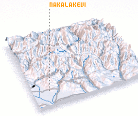 Places with similar names to Nakalakevi, Georgia ::
// Nak'alak'evi (GE)
// Nakalakevi (GE)
Disclaimer :: Information on this page comes without warranty of any kind |
||
|
Where is Nakalakevi? Elevation and coordinates ::
Latitude (lat): 42°13'42"N Longitude (lon): 44°9'43"E
Elevation (approx.): 1445m (map arrows pan, magnifying glasses zoom) |
||
|
Visiting Nakalakevi? Hotel/Accommodation ::
Book a hotel in Nakalakevi Travel Guide ::
Buy a travel guide for Georgia rental cars ::
car rental offers GPS waypoint ::
download a GPX waypoint (PoI) of Nakalakevi for your GPS receiver
|
||