|
search place name
|
||
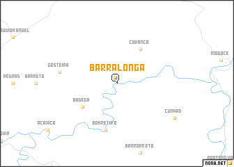
Barra Longa (Minas Gerais, Brazil)Barra Longa is a town in the Minas Gerais region of Brazil. An overview map of the region around Barra Longa is displayed below.
regional and 3d topo map of Barra Longa, Brazil ::
Barra Longa airports ::
The nearest airport is PLU - Belo Horizonte Pampulha Carlos Drummond De Andrade, located 105.7 km north west of Barra Longa.
Other airports nearby include IPN - Ipatinga Usiminas (107.5 km north east), CNF - Belo Horizonte Tancredo Neves Intl (120.1 km north west), JDF - Juiz De Fora Francisco De Assis (170.6 km south), CAW - Campos Bartolomeu Lisandro (240.0 km south east), Nearby towns ::
Covanca (6.6km north east) //
Bodega (6.4km south west) //
Bom Retiro (7.6km south) //
[all distances 'as the bird flies' and approximate] 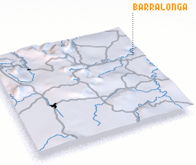 Places with similar names to Barra Longa, Brazil ::
// Barling (US)
// Berlanga (PA)
// Barlinek (PL)
// Berlinka (PL)
// Barluenga (ES)
// Berlanga (ES)
// Bouralangou (BJ)
// Baraléongo (BF)
// Barlanga (IN)
// Bar Olengo (KE)
Disclaimer :: Information on this page comes without warranty of any kind |
||
|
Where is Barra Longa? Elevation and coordinates ::
Latitude (lat): 20°17'0"S Longitude (lon): 43°3'0"W
Elevation (approx.): 384m (map arrows pan, magnifying glasses zoom) |
||
|
Visiting Barra Longa? Hotel/Accommodation ::
Book a hotel in Barra Longa Travel Guide ::
Buy a travel guide for Brazil rental cars ::
car rental offers GPS waypoint ::
download a GPX waypoint (PoI) of Barra Longa for your GPS receiver
|
||