|
search place name
|
||
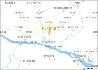
Futuro (Alagoas, Brazil)Futuro is a town in the Alagoas region of Brazil. An overview map of the region around Futuro is displayed below.
regional and 3d topo map of Futuro, Brazil ::
Futuro airports ::
The nearest airport is PAV - Paulo Alfonso Paulo Afonso, located 96.3 km west of Futuro.
Other airports nearby include AJU - Aracaju Santa Maria (145.7 km south), MCZ - Maceio Zumbi Dos Palmares (181.6 km east), Nearby towns ::
Alto da Grota Funda (1.9km south) //
Bom Conselho (1.9km north) //
Pão de Açúcar (3.7km south) //
Estiva (3.7km north) //
Saco Grande (4.1km south west) //
Mato Grosso (4.1km north east) //
Coité (4.1km north west) //
Niterói (5.6km south) //
Floresta (5.6km south) //
Patos (6.6km south west) //
Mocambo (6.7km south east) //
Mirador (6.7km north west) //
Boa Sorte (6.7km north west) //
Meirus (6.6km north east) //
Arapuá (7.3km west) //
Lajinha (8.3km north west) //
Boqueirão (8.3km north west) //
Ipueira (9.2km north east) //
[all distances 'as the bird flies' and approximate] 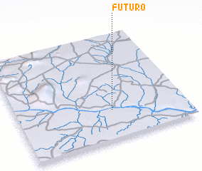 Places with similar names to Futuro, Brazil ::
Disclaimer :: Information on this page comes without warranty of any kind |
||
|
Where is Futuro? Elevation and coordinates ::
Latitude (lat): 9°43'0"S Longitude (lon): 37°26'0"W
Elevation (approx.): 105m (map arrows pan, magnifying glasses zoom) |
||
|
Visiting Futuro? Hotel/Accommodation ::
Book a hotel in Futuro Travel Guide ::
Buy a travel guide for Brazil rental cars ::
car rental offers GPS waypoint ::
download a GPX waypoint (PoI) of Futuro for your GPS receiver
|
||