|
search place name
|
||
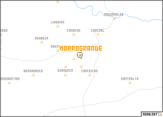
Morro Grande (São Paulo, Brazil)Morro Grande is a town in the São Paulo region of Brazil. An overview map of the region around Morro Grande is displayed below.
regional and 3d topo map of Morro Grande, Brazil ::
Morro Grande airports ::
The nearest airport is QPS - Piracununga Campo Fontenelle, located 46.3 km north of Morro Grande.
Other airports nearby include VCP - Campinas Viracopos (69.4 km south), POO - Pocos De Caldas (88.5 km north east), AQA - Araracuara Araraquara (115.2 km north west), GRU - Sao Paulo Guarulhos Gov Andre Franco Montouro (138.2 km south east), Nearby towns ::
São Vicente (1.9km north) //
Marimbondo (1.7km west) //
Reserva (1.9km south) //
Núcleo Caio Prado (3.9km south west) //
Conceição (4.1km south east) //
Guaiquica (5.0km south west) //
Pântano (5.5km west) //
Camacho (5.8km north) //
Conchal (6.5km north east) //
Limoeiro (9.0km north west) //
[all distances 'as the bird flies' and approximate] 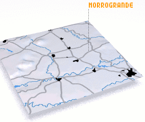 Places with similar names to Morro Grande, Brazil ::
// María Grande (PA)
// María Grande (PA)
// Morro Grande (SV)
// Morro Grande (SV)
// Morro Grande (GT)
// Moro Grande (MX)
// Mar Grande (BR)
// Morro Grande (BR)
// Mara Grand (LR)
// Morro Grande (BR)
Disclaimer :: Information on this page comes without warranty of any kind |
||
|
Where is Morro Grande? Elevation and coordinates ::
Latitude (lat): 22°23'0"S Longitude (lon): 47°12'0"W
Elevation (approx.): 646m (map arrows pan, magnifying glasses zoom) |
||
|
Visiting Morro Grande? Hotel/Accommodation ::
Book a hotel in Morro Grande Travel Guide ::
Buy a travel guide for Brazil rental cars ::
car rental offers GPS waypoint ::
download a GPX waypoint (PoI) of Morro Grande for your GPS receiver
|
||