|
search place name
|
||
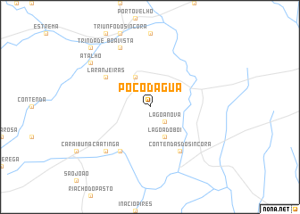
Poço dʼÁgua (Bahia, Brazil)Poço dʼÁgua is a town in the Bahia region of Brazil. An overview map of the region around Poço dʼÁgua is displayed below.
regional and 3d topo map of Poço dʼÁgua, Brazil ::
Nearby towns ::
Lagoa Nova (2.6km south east) //
Pé de Serra (4.1km north west) //
Lagoa do Boi (4.1km south east) //
Bravo (6.6km south west) //
Laranjeiras (6.6km north west) //
Contendas do Sincorá (6.6km south east) //
Caatinga (7.8km south west) //
Boa Vista (8.2km north west) //
Atalho (9.1km north west) //
Trindade (10.3km north west) //
Santo Amaro (10.3km north west) //
[all distances 'as the bird flies' and approximate]  Places with similar names to Poço dʼÁgua, Brazil ::
// Pauktaik (MM)
// Pokodo Auk (MM)
// Pawcatuck (US)
// Pogódki (PL)
// Pikteikiai (LT)
// Pakoudougou (BF)
// Paektŏk (KP)
// Piquete Cué (PY)
// Poço dʼÁgua (BR)
// Počátky (CZ)
Disclaimer :: Information on this page comes without warranty of any kind |
||
|
Where is Poço dʼÁgua? Elevation and coordinates ::
Latitude (lat): 13°42'0"S Longitude (lon): 41°4'0"W
Elevation (approx.): 357m (map arrows pan, magnifying glasses zoom) |
||
|
Visiting Poço dʼÁgua? Hotel/Accommodation ::
Book a hotel in Poço dʼÁgua Travel Guide ::
Buy a travel guide for Brazil rental cars ::
car rental offers GPS waypoint ::
download a GPX waypoint (PoI) of Poço dʼÁgua for your GPS receiver
|
||