|
search place name
|
||
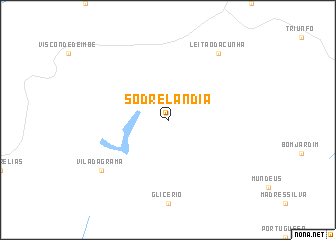
Sodrelândia (Rio de Janeiro, Brazil)Sodrelândia is a town in the Rio de Janeiro region of Brazil. An overview map of the region around Sodrelândia is displayed below.
regional and 3d topo map of Sodrelândia, Brazil ::
Sodrelândia airports ::
The nearest airport is CAW - Campos Bartolomeu Lisandro, located 93.5 km north east of Sodrelândia.
Other airports nearby include SDU - Rio De Janeiro Santos Dumont (140.8 km south west), GIG - Rio De Janeiro Galeao Antonio Carlos Jobim (141.4 km south west), JDF - Juiz De Fora Francisco De Assis (142.0 km west), STU - Rio De Janeiro Santa Cruz (190.8 km south west), Nearby towns ::
Vila da Grama (8.8km south west) //
Leitão da Cunha (9.0km north east) //
[all distances 'as the bird flies' and approximate] 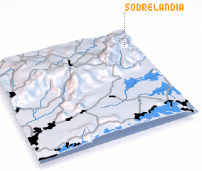 Places with similar names to Sodrelândia, Brazil ::
// Cedar Land (US)
// Starland (US)
// Zuid-Eierland (NL)
// Sidrolândia (BR)
// Store Lind (DK)
// Store Linde (DK)
// Stora Landa (SE)
// Söderlund (FI)
// Cedrolândia (BR)
// Citrolândia (BR)
Disclaimer :: Information on this page comes without warranty of any kind |
||
|
Where is Sodrelândia? Elevation and coordinates ::
Latitude (lat): 22°9'0"S Longitude (lon): 42°4'0"W
Elevation (approx.): 837m (map arrows pan, magnifying glasses zoom) |
||
|
Visiting Sodrelândia? Hotel/Accommodation ::
Book a hotel in Sodrelândia Travel Guide ::
Buy a travel guide for Brazil rental cars ::
car rental offers GPS waypoint ::
download a GPX waypoint (PoI) of Sodrelândia for your GPS receiver
|
||