|
search place name
|
||
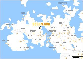
Söderlund (Ahvenanmaa, Finland)Söderlund is a town in the Ahvenanmaa region of Finland. An overview map of the region around Söderlund is displayed below.
regional and 3d topo map of Söderlund, Finland ::
Söderlund airports ::
The nearest airport is MHQ - Mariehamn, located 17.8 km south east of Söderlund.
Other airports nearby include ARN - Stockholm Arlanda (117.2 km south west), BMA - Stockholm Bromma (137.7 km south west), Nearby towns ::
Storhaga (1.2km south) //
Klemes (2.5km south) //
Örliden (2.2km south east) //
Smeds (2.8km south) //
Karls (2.8km south) //
Marby (3.7km south) //
Östergård (2.5km south west) //
Bredbolstad (2.6km north east) //
Överby (2.6km south west) //
Kattnäs (4.2km south) //
Marsund (4.1km south east) //
Bovik (4.1km north east) //
Västerbo (3.1km south east) //
Nordström (4.2km south east) //
Mörby (2.8km east) //
Frebbenby (3.3km south east) //
Björnhuvud (5.6km south) //
Hällesby Sand (5.3km south) //
Norrgård (5.7km south) //
Sandhagen (5.7km south) //
Eckerö (4.6km south west) //
Kyrkoby (3.9km south west) //
Kattby (4.2km south east) //
Böle (4.0km west) //
Nedergård (5.1km south east) //
Månäng (4.4km east) //
Bohem (4.9km south east) //
Hellesby (5.2km south east) //
Östra Mangsjö (6.4km south west) //
[all distances 'as the bird flies' and approximate] 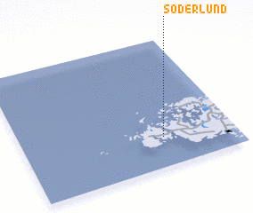 Places with similar names to Söderlund, Finland ::
// Cedar Land (US)
// Starland (US)
// Sodrelândia (BR)
// Zuid-Eierland (NL)
// Sidrolândia (BR)
// Store Lind (DK)
// Store Linde (DK)
// Stora Landa (SE)
// Cedrolândia (BR)
// Citrolândia (BR)
Disclaimer :: Information on this page comes without warranty of any kind |
||
|
Where is Söderlund? Elevation and coordinates ::
Latitude (lat): 60°14'0"N Longitude (lon): 19°40'0"E
(map arrows pan, magnifying glasses zoom) |
||
|
Visiting Söderlund? Hotel/Accommodation ::
Book a hotel in Söderlund Travel Guide ::
Buy a travel guide for Finland rental cars ::
car rental offers GPS waypoint ::
download a GPX waypoint (PoI) of Söderlund for your GPS receiver
|
||