|
search place name
|
||
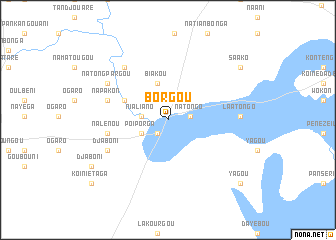
Borgou (Dapaong, Togo)Borgou is a town in the Dapaong region of Togo. An overview map of the region around Borgou is displayed below.
regional and 3d topo map of Borgou, Togo ::
Borgou airports ::
The nearest airport is LRL - Niatougou Niamtougou International, located 123.8 km south east of Borgou.
Other airports nearby include TML - Tamale (206.7 km south west), Nearby towns ::
Boilougou (1.9km south west) //
Natongo (2.5km east) //
Nialiano (3.0km west) //
Poiporga (3.3km south west) //
Biakou (4.2km north) //
Naliénou (5.2km north west) //
Nalénou (6.8km west) //
Napakon (6.9km west) //
Djaboni (7.4km south west) //
Koinétédiouaga (7.6km north west) //
Natongpargou (7.7km north west) //
Napakon (7.7km north west) //
Laatongo (8.0km east) //
Djaboni (9.9km south west) //
Saako (9.9km north east) //
Yagou (10.7km south east) //
Koiniétaga (11.0km south west) //
[all distances 'as the bird flies' and approximate] 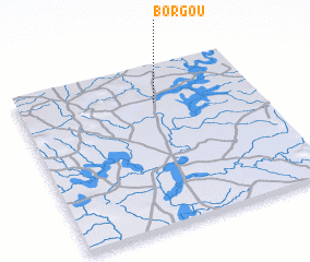 Places with similar names to Borgou, Togo ::
Disclaimer :: Information on this page comes without warranty of any kind |
||
|
Where is Borgou? Elevation and coordinates ::
Latitude (lat): 10°45'49"N Longitude (lon): 0°34'37"W
Elevation (approx.): 157m (map arrows pan, magnifying glasses zoom) |
||
|
Visiting Borgou? Hotel/Accommodation ::
Book a hotel in Borgou Travel Guide ::
Buy a travel guide for Togo rental cars ::
car rental offers GPS waypoint ::
download a GPX waypoint (PoI) of Borgou for your GPS receiver
|
||