|
search place name
|
||
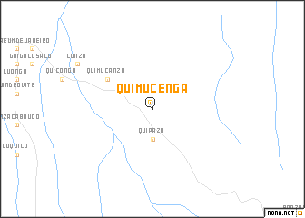
Quimucenga (Uíge, Angola)Quimucenga is a town in the Uíge region of Angola. An overview map of the region around Quimucenga is displayed below.
regional and 3d topo map of Quimucenga, Angola ::
Quimucenga airports ::
The nearest airport is UGO - Uige, located 85.5 km south west of Quimucenga.
Other airports nearby include GXG - Negage (89.3 km south), SSY - M'banza-congo Mbanza Congo (155.3 km north west), Nearby towns ::
Quipaza (3.7km south) //
Quimucanza (6.6km north west) //
[all distances 'as the bird flies' and approximate]  Places with similar names to Quimucenga, Angola ::
// Queimasangue (BR)
// Kamocinek (PL)
// Kumasinka (RU)
// Gombe-Isongo (CD)
// Kamba-Sengo (CD)
// Kamusenga (CD)
// Kamusenga (CD)
// Komsing (IN)
// Kamsango (GH)
// Gua Musang (MY)
Disclaimer :: Information on this page comes without warranty of any kind |
||
|
Where is Quimucenga? Elevation and coordinates ::
Latitude (lat): 6°58'0"S Longitude (lon): 15°28'0"E
Elevation (approx.): 1078m (map arrows pan, magnifying glasses zoom) |
||
|
Visiting Quimucenga? Hotel/Accommodation ::
Book a hotel in Quimucenga Travel Guide ::
Buy a travel guide for Angola rental cars ::
car rental offers GPS waypoint ::
download a GPX waypoint (PoI) of Quimucenga for your GPS receiver
|
||