|
search place name
|
||
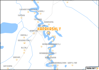
Karakashly (Salyan, Azerbaijan)Karakashly is a town in the Salyan region of Azerbaijan. An overview map of the region around Karakashly is displayed below.
regional and 3d topo map of Karakashly, Azerbaijan ::
Karakashly airports ::
The nearest airport is BAK - Baku Heydar Aliyev, located 133.5 km north east of Karakashly.
Nearby towns ::
Beshtali (1.0km south east) //
Dzhangyan (1.6km east) //
Cǝngan (1.8km south east) //
Kür Qaraqaşlı (2.4km north west) //
Musaly (2.5km south) //
Salyan (3.6km north west) //
Shorkend (4.1km north) //
Şorkǝnd (4.1km north) //
Khodzhaly (4.2km south) //
Arabkardashbeyli (4.4km south) //
Komsomol (5.3km south) //
Kür Qaraqaşlı (5.0km south west) //
Arbatan (4.7km west) //
Bala Surra (6.1km south) //
Tutabag (6.1km north west) //
Arabbabirkhanly (7.9km south) //
Pirǝbbǝ (8.0km south) //
Çuxanlı (8.6km north) //
Aşağı Noxudlu (9.6km north west) //
Yukhary Nokhudlu (10.8km north west) //
[all distances 'as the bird flies' and approximate]  Places with similar names to Karakashly, Azerbaijan ::
// Karakashly (RU)
// Kurgashla (RU)
// Kurgashly (RU)
// Greggs Hill (US)
// Crocus Hill (AI)
// Karukachal (IN)
// Kurukkuchālai (IN)
// Qareh Qāshlī (IR)
// Karakchul' (RU)
Disclaimer :: Information on this page comes without warranty of any kind |
||
|
Where is Karakashly? Elevation and coordinates ::
Latitude (lat): 39°34'14"N Longitude (lon): 49°0'21"E
Elevation (approx.): -21m (map arrows pan, magnifying glasses zoom) |
||
|
Visiting Karakashly? Hotel/Accommodation ::
Book a hotel in Karakashly Travel Guide ::
Buy a travel guide for Azerbaijan rental cars ::
car rental offers GPS waypoint ::
download a GPX waypoint (PoI) of Karakashly for your GPS receiver
|
||