|
search place name
|
||
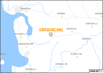
Karukachal (Kerala, India)Karukachal is a town in the Kerala region of India. An overview map of the region around Karukachal is displayed below.
regional and 3d topo map of Karukachal, India ::
Karukachal airports ::
The nearest airport is COK - Cochin, located 63.3 km north west of Karukachal.
Other airports nearby include TRV - Trivandrum Thiruvananthapuram Intl (116.9 km south), IXM - Madurai (164.5 km east), CJB - Coimbatore (175.1 km north), CCJ - Calicut (195.7 km north), Nearby towns ::
 Places with similar names to Karukachal, India ::
// Karakashly (AZ)
// Karakashly (RU)
// Kurgashla (RU)
// Kurgashly (RU)
// Greggs Hill (US)
// Crocus Hill (AI)
// Kurukkuchālai (IN)
// Qareh Qāshlī (IR)
// Karakchul' (RU)
Disclaimer :: Information on this page comes without warranty of any kind |
||
|
Where is Karukachal? Elevation and coordinates ::
Latitude (lat): 9°30'0"N Longitude (lon): 76°38'0"E
Elevation (approx.): 65m (map arrows pan, magnifying glasses zoom) |
||
|
Visiting Karukachal? Hotel/Accommodation ::
Book a hotel in Karukachal Travel Guide ::
Buy a travel guide for India rental cars ::
car rental offers GPS waypoint ::
download a GPX waypoint (PoI) of Karukachal for your GPS receiver
|
||