|
search place name
|
||
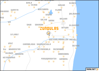
Zünqülǝş (Astara, Azerbaijan)Zünqülǝş is a town in the Astara region of Azerbaijan. An overview map of the region around Zünqülǝş is displayed below.
regional and 3d topo map of Zünqülǝş, Azerbaijan ::
Zünqülǝş airports ::
The nearest airport is RAS - Rasht, located 144.6 km south east of Zünqülǝş.
Other airports nearby include RZR - Ramsar (239.3 km south east), Nearby towns ::
Şuvaş (0.6km south west) //
Alaşa (1.3km east) //
Bībī Yānlū (2.4km south) //
Siyǝtük (2.5km north) //
Kashfī (2.5km south) //
Sǝncǝrǝdi (2.3km north east) //
‘Anbarān Maḩalleh (2.6km south east) //
Sheykh ‘Alī Maḩalleh (3.5km south east) //
Shūndeh Chūlā (4.5km south) //
Sǝrǝk (4.8km north) //
Şuvi (4.9km north) //
Sǝkǝşam (4.5km north west) //
Bāghcheh Sarā (4.1km east) //
Sǝliva (5.3km north) //
Sūpar Beyg (4.7km south east) //
Şayyādlar (5.2km south west) //
Qal'eh (5.0km south east) //
Artupa (5.0km north east) //
Khānehhā-ye Āsīāb (6.2km south) //
Ḩeyrān-e Bālā (6.3km south) //
Bījārābīn (5.9km south east) //
Vīrmūnī (6.1km south east) //
Deqadi (6.9km north) //
Naz̧arābād (6.6km south east) //
Meçidmǝhlǝ (5.6km east) //
Noyabud (7.1km north) //
Ərçivan (6.8km north east) //
Shua (6.8km north west) //
Damīr Ūghlīkesh (7.6km south west) //
[all distances 'as the bird flies' and approximate] 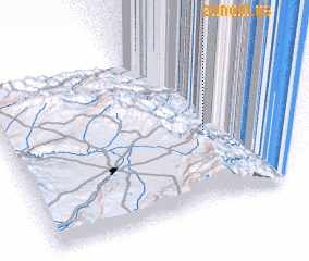 Places with similar names to Zünqülǝş, Azerbaijan ::
// Singlis (DE)
// Cengles (IT)
// San Nicolas (IT)
// San Nicolás (CU)
// San Nicolás (CU)
// San Nicolás (CU)
// San Nicolás (CU)
// San Nicolás (CU)
// San Nicolás (CU)
// San Nicolás (CU)
Disclaimer :: Information on this page comes without warranty of any kind |
||
|
Where is Zünqülǝş? Elevation and coordinates ::
Latitude (lat): 38°27'16"N Longitude (lon): 48°47'10"E
Elevation (approx.): 120m (map arrows pan, magnifying glasses zoom) |
||
|
Visiting Zünqülǝş? Hotel/Accommodation ::
Book a hotel in Zünqülǝş Travel Guide ::
Buy a travel guide for Azerbaijan rental cars ::
car rental offers GPS waypoint ::
download a GPX waypoint (PoI) of Zünqülǝş for your GPS receiver
|
||