|
search place name
|
||
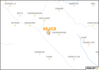
Mojica (Cochabamba, Bolivia)Mojica is a town in the Cochabamba region of Bolivia. An overview map of the region around Mojica is displayed below.
regional and 3d topo map of Mojica, Bolivia ::
Mojica airports ::
The nearest airport is SRE - Sucre Juana Azurduy De Padilla, located 134.5 km south of Mojica.
Other airports nearby include CBB - Cochabamba Jorge Wilsterman (149.2 km west), VVI - Santa Cruz Viru Viru Intl (183.5 km east), POI - Potosi Capitan Nicolas Rojas (207.2 km south west), Nearby towns ::
La Viña (2.6km north east) //
La Viña Perdida (3.5km east) //
Challhuani (5.8km north) //
Huanacuni (8.2km south west) //
Guanacama (8.0km north west) //
Tierras Nuevas (9.1km north west) //
[all distances 'as the bird flies' and approximate] 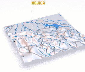 Places with similar names to Mojica, Bolivia ::
Disclaimer :: Information on this page comes without warranty of any kind |
||
|
Where is Mojica? Elevation and coordinates ::
Latitude (lat): 17°52'0"S Longitude (lon): 64°51'0"W
Elevation (approx.): 1950m (map arrows pan, magnifying glasses zoom) |
||
|
Visiting Mojica? Hotel/Accommodation ::
Book a hotel in Mojica Travel Guide ::
Buy a travel guide for Bolivia rental cars ::
car rental offers GPS waypoint ::
download a GPX waypoint (PoI) of Mojica for your GPS receiver
|
||