|
search place name
|
||
Rumeroma (Oruro, Bolivia)Rumeroma is a town in the Oruro region of Bolivia. An overview map of the region around Rumeroma is displayed below.
regional and 3d topo map of Rumeroma, Bolivia ::

Rumeroma airports ::
The nearest airport is LPB - La Paz El Alto Intl, located 178.2 km north of Rumeroma.
Other airports nearby include CBB - Cochabamba Jorge Wilsterman (211.4 km east), Nearby towns ::
Surmoco (1.9km south) //
Pujio (7.7km north east) //
Colacota (8.2km south east) //
Marcarani (8.2km north east) //
Huajlla Pucara (9.0km north west) //
[all distances 'as the bird flies' and approximate] 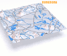 Places with similar names to Rumeroma, Bolivia ::
// Rama-Rama (BR)
// Rumah Rima (MY)
// Rumah Ruma (MY)
// Ramarama (NZ)
// Rāmrāma (BD)
// Ramaram (IN)
// Rāmāram (IN)
// Ramrama (IN)
// Rāmrām (PK)
// Rumi Rumi (PE)
Disclaimer :: Information on this page comes without warranty of any kind |
||
|
Where is Rumeroma? Elevation and coordinates ::
Latitude (lat): 18°7'0"S Longitude (lon): 68°2'0"W
Elevation (approx.): 3931m (map arrows pan, magnifying glasses zoom) |
||
|
Visiting Rumeroma? Hotel/Accommodation ::
Book a hotel in Rumeroma Travel Guide ::
Buy a travel guide for Bolivia rental cars ::
car rental offers GPS waypoint ::
download a GPX waypoint (PoI) of Rumeroma for your GPS receiver
|
||