|
search place name
|
||
Phumĭ Kăt Kôy (Kâmpóng Chhnăng, Cambodia)Phumĭ Kăt Kôy is a town in the Kâmpóng Chhnăng region of Cambodia. An overview map of the region around Phumĭ Kăt Kôy is displayed below.
regional and 3d topo map of Phumĭ Kăt Kôy, Cambodia ::

Phumĭ Kăt Kôy airports ::
The nearest airport is PNH - Phnom-penh Phnom Penh Intl, located 38.7 km south east of Phumĭ Kăt Kôy.
Other airports nearby include REP - Siem-reap Siem Reap (196.1 km north west), SGN - Ho Chi Minh City Tansonnhat Intl (242.5 km south east), Nearby towns ::
Phumĭ Prey Phchœ̆k (1.8km west) //
Phumĭ Mœn Si (2.6km north west) //
Phumĭ Băk Prôlung (4.1km north west) //
Phumĭ Phsar Trach (4.1km south east) //
Phumĭ Bœ̆ng Kák (4.1km north east) //
Phumĭ Âmpŏu Prey (4.1km north west) //
Phumĭ Tăng Trêng (5.2km north west) //
Phumĭ Kăt Prêk (5.2km north west) //
Phumĭ Srăh Châk (5.4km east) //
Phumĭ Svay Pôk (5.6km south) //
Phumĭ Péaréach (5.7km west) //
Phumĭ Néang Méaléa (5.7km west) //
Phumĭ Khyang (5.8km south) //
Phumĭ Bœ̆ng Chhuk (5.8km south) //
Phumĭ Ta Kŏl (5.8km north) //
Phumĭ Bœ̆ng Ângkiĕt (6.6km north east) //
Phumĭ Trâpeăng Buŏn (6.6km south west) //
Phumĭ Prák Kda (6.6km south east) //
Phumĭ Chănlăng (7.6km north) //
Khŭm Péam Lvêk (7.5km east) //
Phumĭ Srê Sa (7.5km west) //
Phumĭ Svay Preăh Chbar (7.5km east) //
Phumĭ Poŭthĭ Kaông (7.6km south) //
Phumĭ Khnŏr Âmpĭl (7.6km south) //
Phumĭ Ângk Sândăn (7.6km south) //
Phumĭ Vôtt Chăs (8.3km south west) //
Phumĭ Véal Ta Léng (8.1km south west) //
Phumĭ Sovôngs (9.2km south west) //
Phumĭ Spéan (9.2km south east) //
[all distances 'as the bird flies' and approximate] 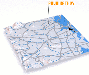 Places with similar names to Phumĭ Kăt Kôy, Cambodia ::
Disclaimer :: Information on this page comes without warranty of any kind |
||
|
Where is Phumĭ Kăt Kôy? Elevation and coordinates ::
Latitude (lat): 11°52'0"N Longitude (lon): 104°42'0"E
Elevation (approx.): 20m (map arrows pan, magnifying glasses zoom) |
||
|
Visiting Phumĭ Kăt Kôy? Hotel/Accommodation ::
Book a hotel in Phumĭ Kăt Kôy Travel Guide ::
Buy a travel guide for Cambodia rental cars ::
car rental offers GPS waypoint ::
download a GPX waypoint (PoI) of Phumĭ Kăt Kôy for your GPS receiver
|
||