|
search place name
|
||
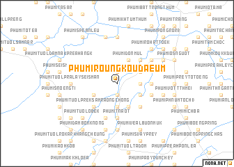
Phumĭ Roŭng Koŭ Daeum (Bătdâmbâng, Cambodia)Phumĭ Roŭng Koŭ Daeum is a town in the Bătdâmbâng region of Cambodia. An overview map of the region around Phumĭ Roŭng Koŭ Daeum is displayed below.
regional and 3d topo map of Phumĭ Roŭng Koŭ Daeum, Cambodia ::
Phumĭ Roŭng Koŭ Daeum airports ::
The nearest airport is REP - Siem-reap Siem Reap, located 95.3 km east of Phumĭ Roŭng Koŭ Daeum.
Other airports nearby include NAK - Nakhon Ratchasima Khorat (190.0 km north west), UTP - Rayong U Taphao Intl (225.1 km west), PNH - Phnom-penh Phnom Penh Intl (294.5 km south east), Nearby towns ::
Phumĭ Baôs Ngĕn (1.9km south) //
Phumĭ Ta Sál (1.9km south) //
Phumĭ Châmnaôm (1.9km north) //
Phumĭ Sœă (3.7km south) //
Phumĭ Koŭk Pônléa (3.6km east) //
Phumĭ Tuŏl Thnóng (4.1km south west) //
Phumĭ Chuŏr Khchăs (4.1km south east) //
Phumĭ Dâng Trang (4.1km south east) //
Phumĭ Srê Prey (4.1km south east) //
Phumĭ Ta Bŭn (4.1km south east) //
Phumĭ Ta Pŏk (4.1km south east) //
Phumĭ Don Mul (4.1km north east) //
Phumĭ Prêk Sâmraông (4.1km north east) //
Phumĭ Tuŏl Prêk Sâmraông Chŏng (5.2km south west) //
Phumĭ Bœ̆ng Trás (5.2km south east) //
Phumĭ Tuŏl Nhung (5.2km south east) //
Phumĭ Châk (5.2km north east) //
Phumĭ Châmkar Chék (5.4km east) //
Phumĭ Buŏr (5.6km south) //
Phumĭ Baôh Laôk (5.6km south) //
Phumĭ Tnaôt (5.6km south) //
Phumĭ Kâmping (5.7km east) //
Phumĭ Ânsâm Chék (5.8km south) //
Phumĭ Dângkaô (1) (6.6km north east) //
Phumĭ Don Ŏk (7.4km south) //
Phumĭ Ta Mau (7.4km south) //
Phumĭ Tuŏl Prâlay Sei Smán (7.2km west) //
Phumĭ Kiĕn Kraôl (7.4km north) //
Phumĭ Bântéay Sdéch (7.6km south) //
[all distances 'as the bird flies' and approximate] 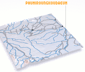 Places with similar names to Phumĭ Roŭng Koŭ Daeum, Cambodia :: Disclaimer :: Information on this page comes without warranty of any kind |
||
|
Where is Phumĭ Roŭng Koŭ Daeum? Elevation and coordinates ::
Latitude (lat): 13°26'0"N Longitude (lon): 102°56'0"E
Elevation (approx.): 18m (map arrows pan, magnifying glasses zoom) |
||
|
Visiting Phumĭ Roŭng Koŭ Daeum? Hotel/Accommodation ::
Book a hotel in Phumĭ Roŭng Koŭ Daeum Travel Guide ::
Buy a travel guide for Cambodia rental cars ::
car rental offers GPS waypoint ::
download a GPX waypoint (PoI) of Phumĭ Roŭng Koŭ Daeum for your GPS receiver
|
||