|
search place name
|
||
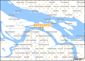
Bara Kāndi (Dhaka, Bangladesh)Bara Kāndi is a town in the Dhaka region of Bangladesh. An overview map of the region around Bara Kāndi is displayed below.
regional and 3d topo map of Bara Kāndi, Bangladesh ::
Bara Kāndi airports ::
The nearest airport is DAC - Dhaka Zia Intl, located 53.3 km north of Bara Kāndi.
Other airports nearby include IXA - Agartala (106.8 km north east), JSR - Jessore (124.5 km west), IRD - Ishurdi (159.8 km north west), CGP - Chittagong Shah Amanat Intl (193.4 km south east), Nearby towns ::
Kuritākār Char (1.6km south) //
Achhānulla Munsir Kāndi (1.6km south) //
Pāthāla Kāndi (1.6km south) //
Dublādānga (1.9km south west) //
Najumaddin Bepārir Kāndi (1.9km south west) //
Dengar Bepārir Kāndi (1.9km south west) //
Ābdul Bepārir Kāndi (1.9km south west) //
Dāimaddin Hājir Kāndi (2.9km west) //
Bhātkul (3.1km north east) //
Dāimaddin Khalifār Kāndi (3.4km south) //
Mulāi Bepārir Kāndi (3.4km south) //
Miāchān Munsir Kāndi (3.4km south) //
Āhādi Mātbarer Kāndi (3.3km south west) //
Sudhanya Mandaler Kāndi (3.3km south west) //
Chhārimamud Sikdārer Kāndi (3.3km south west) //
Kāchhāri Kāndi (3.3km south west) //
Lakhāi Kāzir Kāndi (3.3km south west) //
Umardir Kāndi (3.3km south west) //
Rahimuddin Sikdārer Kāndi (3.6km south) //
Jabberāli Akaner Kāndi (3.6km south) //
Fakirmāmud Akaner Kāndi (3.6km south) //
Budhāi Mātbarer Kāndi (3.6km south) //
Maniruddin Sardārer Kāndi (3.6km south) //
Hāldār Kāndi (3.6km south) //
Kabiraj Kāndi (3.6km south) //
Meherāli Munsir Kāndi (3.6km south) //
Bhānu Mālliker Kāndi (4.0km south east) //
Kāziār Char (4.0km south east) //
Kunder Char (4.2km east) //
[all distances 'as the bird flies' and approximate]  Places with similar names to Bara Kāndi, Bangladesh ::
// Burkuntē (ET)
// Bergante (PH)
// Borgunto (IT)
// Brugneto (IT)
// Börgönd (HU)
// Bergüenda (ES)
// Burgunda (RU)
// Burgunda (RU)
// Bāraikānda (BD)
// Barai Kāndi (BD)
Disclaimer :: Information on this page comes without warranty of any kind |
||
|
Where is Bara Kāndi? Elevation and coordinates ::
Latitude (lat): 23°21'48"N Longitude (lon): 90°21'43"E
Elevation (approx.): 8m (map arrows pan, magnifying glasses zoom) |
||
|
Visiting Bara Kāndi? Hotel/Accommodation ::
Book a hotel in Bara Kāndi Travel Guide ::
Buy a travel guide for Bangladesh rental cars ::
car rental offers GPS waypoint ::
download a GPX waypoint (PoI) of Bara Kāndi for your GPS receiver
|
||