|
search place name
|
||
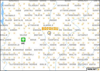
Barakāu (Dhaka, Bangladesh)Barakāu is a town in the Dhaka region of Bangladesh. An overview map of the region around Barakāu is displayed below.
regional and 3d topo map of Barakāu, Bangladesh ::
Barakāu airports ::
The nearest airport is DAC - Dhaka Zia Intl, located 9.3 km west of Barakāu.
Other airports nearby include IXA - Agartala (76.7 km east), IRD - Ishurdi (149.9 km west), JSR - Jessore (154.7 km south west), IXH - Kailashahar (162.3 km east), Nearby towns ::
Māijhgaon (1.0km south west) //
Hārārbāri (1.6km south east) //
Pārābartha (1.6km north east) //
Galān (1.6km north east) //
Bhāturia (2.3km north west) //
Chhota Palāsia (2.3km north west) //
Palāsia (2.3km north west) //
Kuchilābāri (2.8km north) //
Bāimākānda (2.8km north) //
Senpāra (2.8km north) //
Ulukhala (2.8km north) //
Bholānāthpur (2.8km south) //
Pānjora (3.0km north east) //
Ketun (3.0km north east) //
Tek Noādda (3.0km south east) //
Yusafganj (3.0km south east) //
Hirnal (3.1km east) //
Kāmta (3.1km east) //
Tirmara (3.1km east) //
Rāyerdia (3.5km north west) //
Dhopāpāra (3.5km north west) //
Mathbāri (3.5km north west) //
Nāgarbela (3.5km north west) //
Borān (3.5km north west) //
Tālia (3.5km north west) //
Dhelna (3.5km south west) //
Dumni (3.5km south west) //
Mastul (3.5km south west) //
Rāthura (4.0km north east) //
[all distances 'as the bird flies' and approximate] 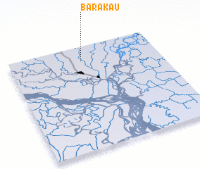 Places with similar names to Barakāu, Bangladesh ::
Disclaimer :: Information on this page comes without warranty of any kind |
||
|
Where is Barakāu? Elevation and coordinates ::
Latitude (lat): 23°51'30"N Longitude (lon): 90°29'16"E
Elevation (approx.): 14m (map arrows pan, magnifying glasses zoom) |
||
|
Visiting Barakāu? Hotel/Accommodation ::
Book a hotel in Barakāu Travel Guide ::
Buy a travel guide for Bangladesh rental cars ::
car rental offers GPS waypoint ::
download a GPX waypoint (PoI) of Barakāu for your GPS receiver
|
||