|
search place name
|
||
Gomgrām (Barisāl, Bangladesh)Gomgrām is a town in the Barisāl region of Bangladesh. An overview map of the region around Gomgrām is displayed below.
regional and 3d topo map of Gomgrām, Bangladesh ::

Gomgrām airports ::
The nearest airport is DAC - Dhaka Zia Intl, located 34.1 km south east of Gomgrām.
Other airports nearby include IRD - Ishurdi (108.5 km west), IXA - Agartala (116.6 km east), JSR - Jessore (130.5 km south west), RJH - Rajshahi Shah Mokhdum (158.9 km west), Nearby towns ::
Bhāgyeswari (0.0km north) //
Āmchhimair (0.0km north) //
Sāsan (1.9km south) //
Hāluāpāra (1.9km south) //
Dakshin Pārāgaon (1.9km south) //
Sripur (1.9km south) //
Paschim Narasingpur (1.9km south) //
Uttar Bāsta (1.7km west) //
Bil Pāllāi (1.7km west) //
Kākarmora (1.7km west) //
Paschim Sutrāpur (1.7km west) //
Paschim Bāichāil (1.7km west) //
Gāotāra (1.9km north) //
Tetāil (1.9km north) //
Purba Sulsulia (1.7km east) //
Bil Kusnāi (1.7km east) //
Ātigaon (1.7km east) //
Gokhura (1.7km east) //
Bāisākānda (1.7km east) //
Bānskota (1.7km east) //
Pāchh Bānskota (1.7km east) //
Kāchhair (1.7km east) //
Durgāpur Gārāil (2.5km south west) //
Kāthālia (2.5km south west) //
Kāsimnagar (2.5km south west) //
Nabagrām (2.5km south west) //
Pānkātta (2.5km south east) //
Kāntāhāti (2.5km south east) //
Dālipāra (2.5km south east) //
[all distances 'as the bird flies' and approximate] 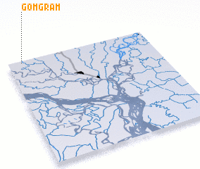 Places with similar names to Gomgrām, Bangladesh ::
Disclaimer :: Information on this page comes without warranty of any kind |
||
|
Where is Gomgrām? Elevation and coordinates ::
Latitude (lat): 23°59'0"N Longitude (lon): 90°6'0"E
Elevation (approx.): 11m (map arrows pan, magnifying glasses zoom) |
||
|
Visiting Gomgrām? Hotel/Accommodation ::
Book a hotel in Gomgrām Travel Guide ::
Buy a travel guide for Bangladesh rental cars ::
car rental offers GPS waypoint ::
download a GPX waypoint (PoI) of Gomgrām for your GPS receiver
|
||