|
search place name
|
||
Kāntinagar (Barisāl, Bangladesh)Kāntinagar is a town in the Barisāl region of Bangladesh. An overview map of the region around Kāntinagar is displayed below.
regional and 3d topo map of Kāntinagar, Bangladesh ::

Kāntinagar airports ::
The nearest airport is IRD - Ishurdi, located 24.7 km north west of Kāntinagar.
Other airports nearby include RJH - Rajshahi Shah Mokhdum (76.5 km north west), JSR - Jessore (84.9 km south), DAC - Dhaka Zia Intl (127.6 km east), CCU - Calcutta Netaji Subhash Chandra Bose Intl (160.5 km south west), Nearby towns ::
Hātāsh Haripur (1.9km south) //
Boāildaha (1.9km south) //
Khās Jayānpur (1.7km west) //
Chuāpāra (1.7km west) //
Lakshmīkol (2.5km south east) //
Sālda Ārāzi (2.5km south west) //
Purātan Kushtia (2.5km south west) //
Raghunāthpur (3.4km east) //
Bārādi (3.7km south) //
Char Kurulia (3.7km north) //
Bhagīrathpur (3.7km north) //
Bāgunda Bāthāpāra (3.7km north) //
Dicree Char Tālbāria (3.4km west) //
Mahānagar (3.4km west) //
Sukdebpur (3.4km west) //
Bāniāpāra (4.1km south east) //
Chhota Lakshmīkol (4.1km south east) //
Char Pratāppur (4.1km north west) //
Dicree Char Jayānpur (4.1km north west) //
Jayānpur (4.1km north west) //
Char Boālgāri (4.1km north west) //
Sālda (3.9km south west) //
Gopīnāthpur (3.9km south west) //
Sultānpur (5.0km south east) //
Kāloa (5.0km south east) //
Rādhāgrām (5.0km south east) //
Mangalbāria (5.0km south west) //
Jogia (5.0km south west) //
Kushtia (5.0km south west) //
[all distances 'as the bird flies' and approximate] 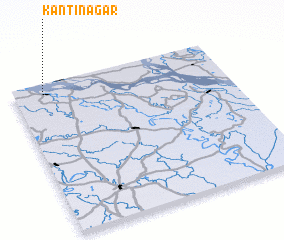 Places with similar names to Kāntinagar, Bangladesh ::
// Cantonu-Gării (RO)
// Kāntanagar (BD)
// Quinta Negra (EC)
// Kiandongoro (KE)
// Kintingourou (SN)
// Gande Nagar (PK)
// Koundianakoro (GN)
// Koundianakoura (GN)
Disclaimer :: Information on this page comes without warranty of any kind |
||
|
Where is Kāntinagar? Elevation and coordinates ::
Latitude (lat): 23°57'0"N Longitude (lon): 89°9'0"E
Elevation (approx.): 6m (map arrows pan, magnifying glasses zoom) |
||
|
Visiting Kāntinagar? Hotel/Accommodation ::
Book a hotel in Kāntinagar Travel Guide ::
Buy a travel guide for Bangladesh rental cars ::
car rental offers GPS waypoint ::
download a GPX waypoint (PoI) of Kāntinagar for your GPS receiver
|
||