|
search place name
|
||
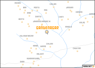
Gande Nagar (Balochistān, Pakistan)Gande Nagar is a town in the Balochistān region of Pakistan. An overview map of the region around Gande Nagar is displayed below.
regional and 3d topo map of Gande Nagar, Pakistan ::
Gande Nagar airports ::
The nearest airport is GWD - Gwadar, located 51.8 km south west of Gande Nagar.
Other airports nearby include PSI - Pasni (56.3 km east), TRB - Turbo Turbat Intl (67.2 km north), PJG - Panjgur (216.2 km north east), Nearby towns ::
Nālod (4.1km north west) //
Jahānnishān Machi (4.3km north west) //
Pahlāra (4.0km west) //
Chīlāni (5.0km south) //
Danno (6.1km south) //
Gwātgi (6.6km north west) //
Hambi (7.1km south west) //
Pārālo (7.3km north west) //
Chāti (7.6km north east) //
Pāg (8.3km north) //
Kul Kaur Bāzār (7.5km west) //
Kandhor Bāzār (8.1km south west) //
Soro (8.0km north west) //
Rāhelo (7.9km east) //
Ziārat (9.1km south west) //
Chagirdi Bāzār (9.3km south west) //
Īsāwāl (9.3km north east) //
Ambi (9.7km north west) //
[all distances 'as the bird flies' and approximate]  Places with similar names to Gande Nagar, Pakistan ::
// Cantonu-Gării (RO)
// Kāntanagar (BD)
// Kāntinagar (BD)
// Quinta Negra (EC)
// Kiandongoro (KE)
// Kintingourou (SN)
// Koundianakoro (GN)
// Koundianakoura (GN)
Disclaimer :: Information on this page comes without warranty of any kind |
||
|
Where is Gande Nagar? Elevation and coordinates ::
Latitude (lat): 25°24'57"N Longitude (lon): 62°48'10"E
Elevation (approx.): 20m (map arrows pan, magnifying glasses zoom) |
||
|
Visiting Gande Nagar? Hotel/Accommodation ::
Book a hotel in Gande Nagar Travel Guide ::
Buy a travel guide for Pakistan rental cars ::
car rental offers GPS waypoint ::
download a GPX waypoint (PoI) of Gande Nagar for your GPS receiver
|
||