|
search place name
|
||
Karamullāpur (Barisāl, Bangladesh)Karamullāpur is a town in the Barisāl region of Bangladesh. An overview map of the region around Karamullāpur is displayed below.
regional and 3d topo map of Karamullāpur, Bangladesh ::

Karamullāpur airports ::
The nearest airport is DAC - Dhaka Zia Intl, located 103.9 km south of Karamullāpur.
Other airports nearby include IRD - Ishurdi (136.5 km south west), IXA - Agartala (142.4 km south east), RJH - Rajshahi Shah Mokhdum (166.1 km west), ZYL - Sylhet Osmani Osmany Intl (168.2 km east), Nearby towns ::
Sibpur (NaNkm north) //
Fatepur (NaNkm north) //
Rāythora (NaNkm north) //
Muktāgācha (1.7km east) //
Kāsipur (1.7km east) //
Nagdāralia (1.7km east) //
Ādhpākhia (1.7km east) //
Bhābki (1.7km east) //
Binodbāri Mānkum (1.9km north) //
Bāde Mājhira (1.9km south) //
Bhattabāri (1.9km south) //
Hālgharia (1.9km south) //
Chandabāri (1.9km south) //
Tegharia (1.7km west) //
Bejbāri (1.7km west) //
Ghāturi (1.7km west) //
Gojānga (1.7km west) //
Rāmkrishnabāri (1.7km west) //
Bāde Kāthāl (1.7km west) //
Mulbāri (1.7km west) //
Rāghābbāri (1.7km west) //
Ketānpur (1.7km west) //
Rajendrabāri (1.7km west) //
Rudrapur (2.5km north east) //
Jayda (2.5km south east) //
Balarāmpur (2.5km north west) //
Bāje Mānkum (2.5km north west) //
Dari Krishnapur (2.5km north west) //
Murāribāri (2.5km south west) //
[all distances 'as the bird flies' and approximate] 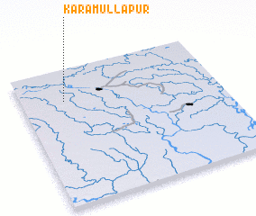 Places with similar names to Karamullāpur, Bangladesh ::
// Karmullāhpur (BD)
// Karmullāhpur (BD)
Disclaimer :: Information on this page comes without warranty of any kind |
||
|
Where is Karamullāpur? Elevation and coordinates ::
Latitude (lat): 24°46'0"N Longitude (lon): 90°13'0"E
Elevation (approx.): 18m (map arrows pan, magnifying glasses zoom) |
||
|
Visiting Karamullāpur? Hotel/Accommodation ::
Book a hotel in Karamullāpur Travel Guide ::
Buy a travel guide for Bangladesh rental cars ::
car rental offers GPS waypoint ::
download a GPX waypoint (PoI) of Karamullāpur for your GPS receiver
|
||