|
search place name
|
||
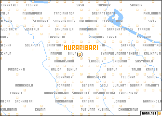
Murāribāri (Barisāl, Bangladesh)Murāribāri is a town in the Barisāl region of Bangladesh. An overview map of the region around Murāribāri is displayed below.
regional and 3d topo map of Murāribāri, Bangladesh ::
Murāribāri airports ::
The nearest airport is DAC - Dhaka Zia Intl, located 102.4 km south of Murāribāri.
Other airports nearby include IRD - Ishurdi (134.1 km south west), IXA - Agartala (142.4 km south east), RJH - Rajshahi Shah Mokhdum (164.1 km west), ZYL - Sylhet Osmani Osmany Intl (170.1 km east), Nearby towns ::
Bishnupur (0.0km north) //
Jot Krishnacharanbāri (0.0km north) //
Sadāsibbāri (0.0km north) //
Benupur (0.0km north) //
Ārāibāria (0.0km north) //
Gobindabāri (0.0km north) //
Rāmpur (0.0km north) //
Kabindabāri (0.0km north) //
Gojānga (1.9km north) //
Ketānpur (1.9km north) //
Mulbāri (1.9km north) //
Tegharia (1.9km north) //
Nimuria (1.9km south) //
Ghāturi (1.9km north) //
Chaugharia (1.9km south) //
Bāde Kāthāl (1.9km north) //
Rāmkrishnabāri (1.9km north) //
Bejbāri (1.9km north) //
Gopināthpur (1.9km south) //
Rāghābbāri (1.9km north) //
Rajendrabāri (1.9km north) //
Simla (1.7km west) //
Bhattabāri (1.7km east) //
Chandabāri (1.7km east) //
Bāde Mājhira (1.7km east) //
Hālgharia (1.7km east) //
Karamullāpur (2.5km north east) //
Chāpuria (2.5km north west) //
Dhitua (2.5km north west) //
[all distances 'as the bird flies' and approximate] 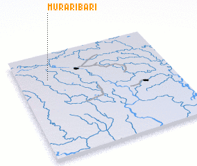 Places with similar names to Murāribāri, Bangladesh ::
// Mirer Bari (BD)
Disclaimer :: Information on this page comes without warranty of any kind |
||
|
Where is Murāribāri? Elevation and coordinates ::
Latitude (lat): 24°45'0"N Longitude (lon): 90°12'0"E
Elevation (approx.): 15m (map arrows pan, magnifying glasses zoom) |
||
|
Visiting Murāribāri? Hotel/Accommodation ::
Book a hotel in Murāribāri Travel Guide ::
Buy a travel guide for Bangladesh rental cars ::
car rental offers GPS waypoint ::
download a GPX waypoint (PoI) of Murāribāri for your GPS receiver
|
||