|
search place name
|
||
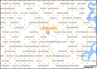
Lohājuri (Barisāl, Bangladesh)Lohājuri is a town in the Barisāl region of Bangladesh. An overview map of the region around Lohājuri is displayed below.
regional and 3d topo map of Lohājuri, Bangladesh ::
Lohājuri airports ::
The nearest airport is IXA - Agartala, located 56.5 km south east of Lohājuri.
Other airports nearby include DAC - Dhaka Zia Intl (59.4 km south west), IXH - Kailashahar (121.3 km east), ZYL - Sylhet Osmani Osmany Intl (134.7 km north east), IRD - Ishurdi (179.7 km west), Nearby towns ::
Jālālpur (0.0km north) //
Char Pakshia (1.7km west) //
Chhota Gajāra (2.5km north east) //
Jhākālia (2.5km north west) //
Purbba Charparātala (2.5km south west) //
Pāikan (2.5km south west) //
Pirijpur (3.4km east) //
Chariākona (3.7km north) //
Masalla (3.7km north) //
Kāmārkona (3.7km north) //
Char Kāonia (3.7km south) //
Bhāwāler Char (3.7km south) //
Char Galgalia (3.4km west) //
Duāigaon (3.9km north east) //
Zaffarpur (4.1km north east) //
Kāmārbhog (4.1km north east) //
Bharārdia (4.1km north east) //
Kāheterteki (4.1km north east) //
Dari Chariākona (4.1km north east) //
Bhogpāra (4.1km north west) //
Nawākāndi (4.1km north west) //
Binyābāid (4.1km south west) //
Char Krishnapur (4.1km south west) //
Jāmālpur (4.1km south west) //
Krishnapur (3.9km south west) //
Bhayasān (3.9km south west) //
Naburia (5.0km north east) //
Gobāria Ābdullāpur (5.0km south east) //
Rāmdi (5.0km north west) //
[all distances 'as the bird flies' and approximate] 
Disclaimer :: Information on this page comes without warranty of any kind |
||
|
Where is Lohājuri? Elevation and coordinates ::
Latitude (lat): 24°13'0"N Longitude (lon): 90°49'0"E
Elevation (approx.): 13m (map arrows pan, magnifying glasses zoom) |
||
|
Visiting Lohājuri? Hotel/Accommodation ::
Book a hotel in Lohājuri Travel Guide ::
Buy a travel guide for Bangladesh rental cars ::
car rental offers GPS waypoint ::
download a GPX waypoint (PoI) of Lohājuri for your GPS receiver
|
||