|
search place name
|
||
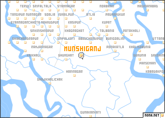
Munshīganj (Barisāl, Bangladesh)Munshīganj is a town in the Barisāl region of Bangladesh. An overview map of the region around Munshīganj is displayed below.
regional and 3d topo map of Munshīganj, Bangladesh ::
Munshīganj airports ::
The nearest airport is CCU - Calcutta Netaji Subhash Chandra Bose Intl, located 85.1 km north west of Munshīganj.
Other airports nearby include JSR - Jessore (103.4 km north), IRD - Ishurdi (210.9 km north), DAC - Dhaka Zia Intl (217.9 km north east), Nearby towns ::
Dhumghāt (3.4km west) //
Ābād Chandīpur (4.1km north east) //
Harinagar (4.1km south west) //
Srīfalkāti (5.1km north west) //
Jābākhāli (5.8km north) //
Gutlikāti (5.8km north) //
Khāgrāghāt (5.8km north) //
Gumāntali (6.5km north east) //
Bhairabnagar (6.3km north west) //
Porākātla (7.1km east) //
Kāsipur (7.6km north) //
Tālbāria (7.6km north east) //
Bangsipur (7.6km north west) //
Buri Goālini (7.8km north east) //
Khāgrādāna (8.2km north west) //
Iswarīpur (8.2km north west) //
Kupat (9.0km north east) //
Chingrākhāli (8.8km north west) //
Dhaji Khāli Chak (8.8km south west) //
Fulbāri (9.0km north west) //
Kalyān (10.1km north west) //
Mahmūdpur (10.1km north west) //
Jādabpur (10.1km north west) //
[all distances 'as the bird flies' and approximate] 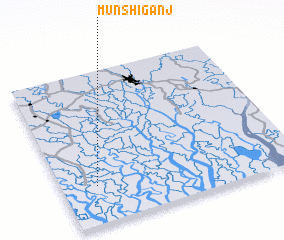 Places with similar names to Munshīganj, Bangladesh ::
// Munshīganj (BD)
// Munshiganj (BD)
Disclaimer :: Information on this page comes without warranty of any kind |
||
|
Where is Munshīganj? Elevation and coordinates ::
Latitude (lat): 22°15'0"N Longitude (lon): 89°9'0"E
Elevation (approx.): -1m (map arrows pan, magnifying glasses zoom) |
||
|
Visiting Munshīganj? Hotel/Accommodation ::
Book a hotel in Munshīganj Travel Guide ::
Buy a travel guide for Bangladesh rental cars ::
car rental offers GPS waypoint ::
download a GPX waypoint (PoI) of Munshīganj for your GPS receiver
|
||