|
search place name
|
||
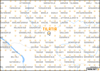
Tilatia (Barisāl, Bangladesh)Tilatia is a town in the Barisāl region of Bangladesh. An overview map of the region around Tilatia is displayed below.
regional and 3d topo map of Tilatia, Bangladesh ::
Tilatia airports ::
The nearest airport is DAC - Dhaka Zia Intl, located 105.3 km south of Tilatia.
Other airports nearby include IXA - Agartala (121.5 km south east), ZYL - Sylhet Osmani Osmany Intl (134.5 km east), IXH - Kailashahar (156.7 km east), IRD - Ishurdi (167.4 km south west), Nearby towns ::
Sālihar (1.9km south) //
Nandura (1.7km east) //
Gajandar (1.7km east) //
Sāhābāzpur (1.7km east) //
Lālma (1.7km west) //
Bekārkānda (2.5km south east) //
Gouripur (2.5km south east) //
Āmsola (2.5km south west) //
Ghiduāri (2.5km north west) //
Chāndpur (2.5km north west) //
Lāmāpāra (2.5km north east) //
Mujāhardi (3.4km west) //
Guzikhān (3.7km south) //
Tātkura (3.7km south) //
Sātati (3.7km south) //
Iusufābād (3.7km south) //
Gābhisimul (3.4km east) //
Bāraipāra (3.4km east) //
Dhulipāra (3.4km east) //
Palāndar (3.4km east) //
Sātpāi (3.7km north) //
Kotrāgaon (3.7km north) //
Simulia (3.7km north) //
Kāsimpur (3.7km north) //
Bhātiāpāra (3.8km south west) //
Kāgchar (3.8km south west) //
Nagua (3.8km north west) //
Chāndersātia (4.1km south west) //
Churāli (4.1km south west) //
[all distances 'as the bird flies' and approximate] 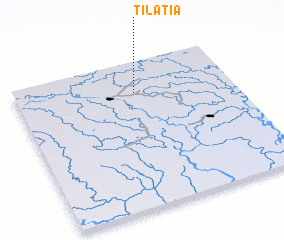 Places with similar names to Tilatia, Bangladesh ::
Disclaimer :: Information on this page comes without warranty of any kind |
||
|
Where is Tilatia? Elevation and coordinates ::
Latitude (lat): 24°47'0"N Longitude (lon): 90°33'0"E
Elevation (approx.): 15m (map arrows pan, magnifying glasses zoom) |
||
|
Visiting Tilatia? Hotel/Accommodation ::
Book a hotel in Tilatia Travel Guide ::
Buy a travel guide for Bangladesh rental cars ::
car rental offers GPS waypoint ::
download a GPX waypoint (PoI) of Tilatia for your GPS receiver
|
||