|
search place name
|
||
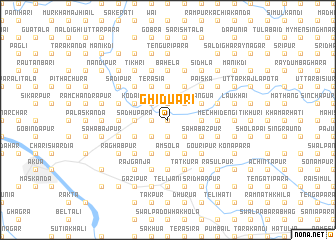
Ghiduāri (Barisāl, Bangladesh)Ghiduāri is a town in the Barisāl region of Bangladesh. An overview map of the region around Ghiduāri is displayed below.
regional and 3d topo map of Ghiduāri, Bangladesh ::
Ghiduāri airports ::
The nearest airport is DAC - Dhaka Zia Intl, located 106.9 km south of Ghiduāri.
Other airports nearby include IXA - Agartala (124.0 km south east), ZYL - Sylhet Osmani Osmany Intl (135.9 km east), IXH - Kailashahar (158.9 km east), IRD - Ishurdi (166.6 km south west), Nearby towns ::
Chāndpur (0.0km north) //
Nagua (1.7km west) //
Khicha (1.9km north) //
Bātikura (1.9km north) //
Lālma (1.9km south) //
Kākani Kona (2.5km north west) //
Gajaharpur (2.5km north west) //
Mujāhardi (2.5km south west) //
Simulia (2.5km north east) //
Kāsimpur (2.5km north east) //
Kotrāgaon (2.5km north east) //
Sātpāi (2.5km north east) //
Tilatia (2.5km south east) //
Sādhupāra (3.4km west) //
Sānura (3.7km north) //
Āmsola (3.7km south) //
Lāmāpāra (3.4km east) //
Terasia (4.1km north west) //
Sādullāpur (4.1km north west) //
Ātādār (4.1km north west) //
Kāgchar (4.1km south west) //
Bhātiāpāra (4.1km south west) //
Dohāra (3.8km north west) //
Kodālia (3.8km north west) //
Dayārāmpur (3.8km south west) //
Charpāra (4.1km north east) //
Beltali (4.1km north east) //
Manāti (4.1km north east) //
Sālihar (4.1km south east) //
[all distances 'as the bird flies' and approximate] 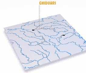 Places with similar names to Ghiduāri, Bangladesh ::
Disclaimer :: Information on this page comes without warranty of any kind |
||
|
Where is Ghiduāri? Elevation and coordinates ::
Latitude (lat): 24°48'0"N Longitude (lon): 90°32'0"E
Elevation (approx.): 12m (map arrows pan, magnifying glasses zoom) |
||
|
Visiting Ghiduāri? Hotel/Accommodation ::
Book a hotel in Ghiduāri Travel Guide ::
Buy a travel guide for Bangladesh rental cars ::
car rental offers GPS waypoint ::
download a GPX waypoint (PoI) of Ghiduāri for your GPS receiver
|
||