|
search place name
|
||
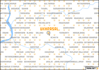
Ukhrāsāl (Barisāl, Bangladesh)Ukhrāsāl is a town in the Barisāl region of Bangladesh. An overview map of the region around Ukhrāsāl is displayed below.
regional and 3d topo map of Ukhrāsāl, Bangladesh ::
Ukhrāsāl airports ::
The nearest airport is DAC - Dhaka Zia Intl, located 61.5 km south west of Ukhrāsāl.
Other airports nearby include IXA - Agartala (65.2 km south east), IXH - Kailashahar (126.0 km east), ZYL - Sylhet Osmani Osmany Intl (134.5 km north east), IRD - Ishurdi (175.0 km west), Nearby towns ::
Bāniāgaon (0.0km north) //
Bhānjania (0.0km north) //
Ganergaon (1.7km east) //
Gāngkulpāra (1.7km east) //
Bhitādia (1.7km east) //
Masua (1.9km south) //
Pang Mausa (1.9km south) //
Pānchgātia (1.9km north) //
Āchmita (2.5km south east) //
Hārina (2.5km north east) //
Madhyapāra (2.5km north east) //
Rupsa (2.5km north west) //
Kalādia (2.5km north west) //
Kumri (2.5km north west) //
Āhutia (2.5km north west) //
Ghilākāndi (3.7km north) //
Beldi (3.4km west) //
Sāluadi (3.4km west) //
Bāgrāit (3.9km south east) //
Chāripāra (3.9km south east) //
Rāmdi (4.1km south east) //
Ashtagharia (3.9km south east) //
Ādampur Manoharpur (4.1km south east) //
Betāl (4.1km south east) //
Pāiksa (3.9km north east) //
Mugdia (4.1km south west) //
Bairāgir Char (4.1km south west) //
Bil Chātalia (4.1km north east) //
Kareha (3.9km south west) //
[all distances 'as the bird flies' and approximate] 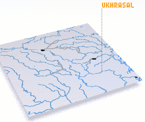
Disclaimer :: Information on this page comes without warranty of any kind |
||
|
Where is Ukhrāsāl? Elevation and coordinates ::
Latitude (lat): 24°17'0"N Longitude (lon): 90°46'0"E
Elevation (approx.): 13m (map arrows pan, magnifying glasses zoom) |
||
|
Visiting Ukhrāsāl? Hotel/Accommodation ::
Book a hotel in Ukhrāsāl Travel Guide ::
Buy a travel guide for Bangladesh rental cars ::
car rental offers GPS waypoint ::
download a GPX waypoint (PoI) of Ukhrāsāl for your GPS receiver
|
||